Drone

The increasing number of wildfires damages nature and human life, making the early detection of wildfires in complex outdoor environments critical. With the advancement of drones and remote sensing technology, infrared cameras have become essential for wildfire detection. However, as the demand for higher accuracy in detection algorithms grows, the detection model's size and computational costs increase, making it challenging to deploy high-precision detection algorithms on edge computing devices onboard drones for real-time fire detection.
- Categories:
 234 Views
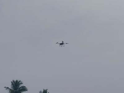
In the captured image, a drone is seen in flight, displaying its advanced technological features and capabilities. The image highlights the drone's robust design and aerodynamic structure, which are essential for its diverse applications in research and development. Drones, also known as Unmanned Aerial Vehicles (UAVs), are increasingly being utilized in various fields due to their ability to collect data from hard-to-reach or hazardous areas.
- Categories:
 324 Views
The deployment of unmanned aerial vehicles (UAV) for logistics and other civil purposes is consistently disrupting airspace security. Consequently, there is a scarcity of robust datasets for the development of real-time systems that can checkmate the incessant deployment of UAVs in carrying out criminal or terrorist activities. VisioDECT is a robust vision-based drone dataset for classifying, detecting, and countering unauthorized drone deployment using visual and electro-optical infra-red detection technologies.
- Categories:
 8481 Views
We design a solution to achieve coordinated localization between two unmanned aerial vehicles (UAVs) using radio and camera perception. We achieve the localization between the UAVs in the context of solving the problem of UAV Global Positioning System (GPS) failure or its unavailability. Our approach allows one UAV with a functional GPS unit to coordinate the localization of another UAV with a compromised or missing GPS system. Our solution for localization uses a sensor fusion and coordinated wireless communication approach.
- Categories:
 504 Views
This dataset inludes a nonlinear disturbance observer (NDOB)-based controller for attitude and altitude control of a quadrotor. The NDOB is used to estimate and compensate disturbances that are imposed naturally on the quadrotor due to aerodynamics and parameter uncertainties. It is demonstrated herein that the proposed observer can estimate external disturbances asymptotically.
- Categories:
 652 Views
The DroneDetect dataset consists of 7 different models of popular Unmanned Aerial Systems (UAS) including the new DJI Mavic 2 Air S, DJI Mavic Pro, DJI Mavic Pro 2, DJI Inspire 2, DJI Mavic Mini, DJI Phantom 4 and the Parrot Disco. Recordings were collected using a Nuand BladeRF SDR and using open source software GNURadio. There are 4 subsets of data included in this dataset, the UAS signals in the presence of Bluetooth interference, in the presence of Wi-Fi signals, in the presence of both and with no interference.
- Categories:
 15738 Views
GPS spoofing and jamming are common attacks against the UAV, however, conducting these experiments for research can be difficult in many areas. This dataset consists of a logs from simulation and live fights. Logs include data from a benign flight as well as one where the UAV experiences an attack.
Simulated Attacks
Note: This is not the most accurate of the data. We recommend using the live GPS Spoofing and Jamming data if possible.
- Categories:
 19540 Views
This dataset is in support of my 3 research papers - 'Comparative SoC Analysis using Non-Linear Kalman Estimation in 8RC ECM of 72Ah LIB - Part I', ' Comparative SoC Analysis using Non-Linear Kalman Estimation in 8RC ECM of 72Ah LIB - Part II' , and 'Comparative SoC Analysis using Non-Linear Kalman Estimation in 8RC ECM of 72Ah LIB - Part III'.
- Categories:
 7130 Views


