Sensors
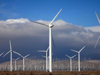
This dataset contains high-resolution solar and wind measurement data collected from the Feni region, Bangladesh, spanning from 2017 to 2019. Logged at a 1-minute interval, the dataset provides a comprehensive record of atmospheric and meteorological conditions, essential for renewable energy analysis, climatological studies, and resource assessment.
- Categories:
This dataset contains high-resolution wind measurement data collected from 22 channels at varying heights, providing valuable insights for wind energy assessment, atmospheric research, and meteorological studies. The dataset includes wind speed, wind direction, and environmental parameters measured at multiple altitudes ranging from 10m to 120m. Each channel records parameters such as average wind speed, standard deviation, minimum and maximum values, gust speed, and wind vane direction. Additionally, atmospheric parameters such as temperature, relative humidity, and pressure are included.
- Categories:
The overall process of UWB technology-based signal preprocessing and high-precision localization system architecture can be divided into two complementary modules: perception and localization. In “Sensing Scene”, the system firstly collects the CIR data generated in the environment through UWB sensors, and applies signal conversion and multi-dimensional feature mapping methods to analyze the signal attenuation characteristics of different NLOS environments, so as to realize the segmentation of the NLOS scene.
- Categories:
Flexible tactile sensors have attracted significant interest in robotics, medical monitoring, and wearable devices. This paper presents a capacitive flexible tactile sensor that employs a nickel carbonyl powder (NCP)-silicone rubber (SR) composite for pressure and bending sensing, fabricated using magnetic field curing. The performance of the sensor is evaluated independently for pressure and bending sensing, including sensitivity, response time, repeatability, and cyclic stability.
- Categories:

Solar Insecticidal Lamps Internet of Things (SIL-IoTs) is an advanced agricultural IoT system integrating solar insecticidal lamps with wireless sensor networks. It attracts pests with light, then kills them with high-voltage metal grids. Equipped with wireless communication modules and environmental sensors, SIL-IoTs can collect and transmit field data, including pest counts (discharge pulse counts, insect-killing sound pulse counts), environmental data (air temperature, humidity, light intensity, equipment box temperature), and operational status.
- Categories:
This dataset contains deep-sea measured sound velocity profile (SVP) data, which was used in a hybrid experiment that integrates both real-world measurements and simulations for ultra-short baseline (USBL) acoustic positioning. The dataset supports research on underwater acoustic propagation, sound ray tracing, and positioning accuracy improvements. By utilizing actual deep-sea SVP data, the hybrid experimental approach enhances the realism and reliability of USBL performance evaluation.
- Categories:
This dataset accompanies the study “Universal Metrics to Characterize the Performance of Imaging 3D Measurement Systems with a Focus on Static Indoor Scenes” and provides all measurement data, processing scripts, and evaluation code necessary to reproduce the results. It includes raw and processed point cloud data from six state-of-the-art 3D measurement systems, captured under standardized conditions. Additionally, the dataset contains high-speed sensor measurements of the cameras’ active illumination, offering insights into their optical emission characteristics.
- Categories:

The attachment "serial_data_dvl_20240729.txt" presents the DVL sensor data collected during the experiment in this paper, including information such as timestamps, transducer data, and velocity. The line beginning with "wru" indicates the status and information of the four transducers. The four data points following "wrx" represent, in sequence, the time interval since the last data collection (in milliseconds), x-axis velocity, y-axis velocity, and z-axis velocity. The four numbers following "wrt" represent the distances from the four transducers to the seabed.
- Categories:
The dataset consists of aerial images captured using a UAV (Unmanned Aerial Vehicle) along with metadata detailing the camera's position, orientation, and settings during the image acquisition process. This dataset was created for the purpose of evaluating algorithms for matching camera images to satellite images. Each data entry includes:
- Categories: