Image Processing
This dataset contains high-resolution retinal fundus images collected from 495 unique subjects from Eye Care hospital in Aizawl, Mizoram, for diabetic retinopathy (DR) detection and classification. The images were captured over five years using the OCT RS 330 device, which features a 45° field of view (33° for small-pupil imaging), a focal length of 45.7 mm, and a 6.25 mm sensor width. Each image was acquired at a resolution of 3000x3000 pixels, ensuring high diagnostic quality and the visibility of subtle features like microaneurysms, exudates, and hemorrhages.
- Categories:
 853 Views
Facility agriculture and arable land data play crucial roles in modern agricultural management and sustainable development. Accurate and up-to-date information regarding facility agriculture, including greenhouses, hydroponic systems, and other controlled environments, enables farmers and policymakers to make informed decisions. It helps in optimizing resource use, improving crop yields, and ensuring food security. Meanwhile, arable land data are essential for monitoring and managing the availability and quality of land suitable for cultivation.
- Categories:
 89 Views
The proper evaluation of food freshness is critical to ensure safety, quality along with customer satisfaction in the food industry. While numerous datasets exists for individual food items,a unified and comprehensive dataset which encompass diversified food categories remained as a significant gap in research. This research presented UC-FCD, a novel dataset designed to address this gap.
- Categories:
 396 Views
Brain tumors are among the most severe and life-threatening conditions affecting both children and adults. They constitute approximately 85-90% of all primary Central Nervous System (CNS) tumors, with an estimated 11,700 new cases diagnosed annually. The 5-year survival rate for individuals with malignant brain or CNS tumors is alarmingly low, at 34% for men and 36% for women. Brain tumors are categorized into various types, including benign, malignant, and pituitary tumors.
- Categories:
 563 Views
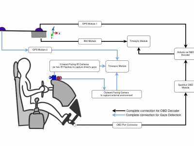
Repeated Route Naturalistic Driving Dataset (R2ND2) is a dual-perspective dataset for driver behavior analysis constituent of vehicular data collected using task-specific CAN decoding sensors using OBD port and external sensors, and (b) gaze-measurements collected using industry-standard multi-camera gaze calibration and collection system. Our experiment is designed to consider the variability associated with driving experience that depends on the time of day and provides valuable insights into the correlation of these additional metrics on driver behavior.
- Categories:
 468 Views
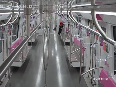
This dataset analyzes rail transit carriage occupancy levels, categorizing crowd density into three distinct classifications. The data collection process involved systematic monitoring of passenger distribution within subway cars during various operational hours, encompassing peak and off-peak periods. Each classification represents different degrees of crowding, providing valuable insights into passenger flow patterns and capacity utilization.
- Categories:
 309 Views
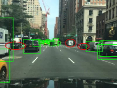
To address common issues in intelligent driving, such as small object missed detection, false detection, and edge segmentation errors, this paper optimizes the YOLOP (You Only Look Once for Panoptic Driving Perception) network and proposes a multi-task perception algorithm based on a MKHA (Multi-Kernel Hybrid Attention) mechanism, named MKHA-YOLOP.
- Categories:
 135 Views
The paper presents a novel dataset of continuous, high-quality, contactless fingerprint image streams of the right-hand thumb finger captured from 46 participants, along with synchronized heart rate measurements. The presented dataset was captured with the help of an off-the-shelf monochrome blue-light fingerprint scanner of 500 ppi with 14 fps, accompanied by a commercially available smartwatch for measuring heart rates.
- Categories:
 110 Views
As coal mining extends to greater depths, accurately detecting coal seam floor undulations, identifying coal thickness variations, and recognizing complex geological features such as collapse columns has become increasingly essential. These challenges raise higher demands for safety and efficiency in mining operations. This study proposes a dynamic interpretation method for intelligent mining faces based on 3D seismic data to enhance the accuracy of detecting coal seam geological structures.
- Categories:
 41 Views


