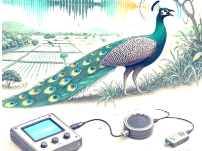
Agriculture

This dataset contains 60,000 annotated records modeling UAV-based and IoT sensor-driven agriculture environments. Each record includes UAV imaging data (NDVI, NDRE, RGB damage score), IoT sensor values (NPK, pH, moisture, temperature, humidity), semantic labels (NDI, PDI), and metadata for energy consumption, latency, and service migration. It is designed for validating Digital Twin frameworks, semantic communication models, and Federated Deep Reinforcement Learning (FDRL) in precision farming.

Categories:
89 Views

Plant diseases remain a significant threat to global agriculture, necessitating rapid and

accurate detection to minimize crop loss. This paper presents a lightweight, end-to-end system for plant

leaf disease detection and severity estimation, optimized for real-time field deployment. We propose a

custom Convolutional Neural Network (CNN), built using PyTorch, trained on the PlantVillage dataset

to classify leaves as healthy or diseased with a test accuracy of 92.06%. To enhance its practical relevance,

Categories:
49 Views

The system consists of an UAVs remote sensing system and an edge computing system. The core components of the UAVs remote sensing system mainly consist of the imaging system K510 development board and a 5G module. The K510 comes equipped with a camera and an LCD screen. The edge computing system constructed in this paper utilizes the NVIDIA Jetson series development kit, which comes with a GPU module to enhance digital image processing capabilities. The captured raw images are stitched and displayed on the NVIDIA Jetson edge computing platform using our designed improved SFIT algorithm.

Categories:
41 Views

The dataset was captured from a vineyard in Bagnolo San Vito, Italy. The dataset comprises sensor readings and high-resolution images collected from 24 March 2024 to 24 December 2024, using one high-resolution camera and a LoRaWAN network of 2 air sensors and 6 soil sensors. The sensors measured air temperature and humidity, soil dielectric permittivity, and soil temperature every 10 minutes. The camera captured one 4-Mpixel RGB image per day.

Categories:
97 Views

This dataset presents longitudinal measurements of plant growth characteristics under varying lighting conditions. Collected for 30 individual plants, the data spans multiple time points and includes key variables such as plant fresh weight (g), plant height (mm), plant width (mm), and number of leaves. Each measurement is associated with a specific plant, date (DD/MM/YYYY), experimental group, and a lighting recipe defined by the percentage composition of Red, Green, and Blue light.

Categories:
49 Views

The Lemon Leaf Disease Dataset (LLDD) is a high-quality image dataset designed for training and evaluating machine learning models for lemon leaf disease classification. The dataset contains 9  classes of images of healthy and diseased lemon leaves, such as; Anthracnose. Bacterial Blight, Citrus Canker, Curl Virus, Deficiency Leaf, Dry Leaf, Healthy Leaf, Sooty Mould, Spider Mites, making it suitable for tasks such as plant disease instance segmentation, detection, image classification, and deep learning applications in agriculture.

Categories:
214 Views

These folders contain images showcasing various aspects of orange fruit and  leaf diseases, including black spot, greening, scap, canker diseases, melanose, and healthy leaves. The dataset serves as a valuable resource for research, machine learning model training, and analysis in the field of citrus diseases and nutrient imbalances.

Categories:
129 Views

we develop a spatio-spectral-temporal deep learning regression model , termed CASST-Net, which leverages a cosine attention mechanism to enhance feature representation to improve FVC estimation accuracy, can also dynamically adjusted the weighting values of each spectral band in the satellite data based on changes in vegetation physiological characteristics and canopy structure.

Categories:
28 Views

we develop a spatio-spectral-temporal deep learning regression model , termed CASST-Net, which leverages a cosine attention mechanism to enhance feature representation to improve FVC estimation accuracy, can also dynamically adjusted the weighting values of each spectral band in the satellite data based on changes in vegetation physiological characteristics and canopy structure.

Categories:
7 Views

This dataset comprises 30 CSV files featuring text-based narratives developed as part of the MOVING (MOuntain Valorisation through INterconnectedness and Green Growth) Horizon 2020 project, which explores 454 value chains across 23 rural regions in 16 European countries. Additionally, it includes 30 JSON files that annotate the keywords within these narratives, linking them to their corresponding Wikidata entries and QIDs.

Categories:
54 Views

Pages