Sensors
The number of private vehicles is still increasing from year to year. In order to limit environmental damage, a proper way of dealing with this trend is the introduction of intelligent automotive infrastructure. Besides traffic management solutions, smart parking guidance systems are important for reducing unnecessary traffic. For this, a key prerequisite are sensor networks that provide information about the occupancy state of every single parking spot in the parking infrastructure of high traffic targets e.g. nearby an airport or shopping mall.
- Categories:
 900 Views
This data set was generated and used in determining the workability of a homemade Intelligent IoT Weather Station Using an Embedded System.
- Categories:
 525 Views
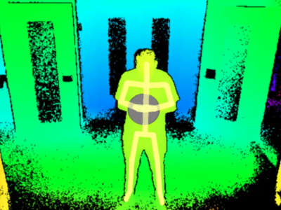
ReSysTDepth collects trajectories of people in indoor spaces. Each trajectory is composed of a sequence of three-dimensional coordinates that capture the center of mass of people moving in the corridor of a building. It is composed of two datasets:
- Real Dataset - real data captured by a depth camera (Microsoft Kinect v2).
- Synthetic dataset - synthetic data generated artificially using splines.
- Categories:
 295 Views
A synthetic dataset designed to evaluate transfer learning performance for RF domain adaptation in the publication Assessing the Value of Transfer Learning Metrics for RF Domain Adaptation. The dataset contains a total of 13.8 million examples, with 600k examples each of 22 modulation schemes (given below) and AWGN noise (200k each for training, validation, and testing); 512 raw IQ samples per example.
- Categories:
 1415 Views
Minimally-Invasive Surgeries can benefit from having miniaturized sensors on surgical graspers to provide additional information to the surgeons. One such potential sensor is an ultrasound transducer. At long travel distances, the ultrasound transducer can accurately measure its ultrasound wave's time of flight, and from it, classify the grasped tissue. However, the ultrasound transducer has a ringing artifact arising from the decaying oscillation of its piezo element, and at short travel distances, the artifact blends with the acoustic echo.
- Categories:
 853 Views
Context awareness is an emerging field in pervasive computing with applications that have started to emerge in medical systems. The present work seeks to determine which contexts are important for medical applications and what various domains of context aware applications exist in healthcare. Methods: A systematic scoping review of context aware medical systems currently being used in healthcare settings was conducted.
- Categories:
 334 Views
The ANDON tower uses the low-cost NRF24L01 transceiver to send the experimental data from the sensor node to the coordinator node, with a computer connected to the coordinator node to store the data in a CSV file. The transceiver uses the SPI protocol for communication with the ANDON tower microcontroller. Its maximum range is 30 meters, however the maximum distance in the experimental scenario is 16 m. The transceiver works in the 2.4GHz free band and allows setting the transmission power in -18dBm, -12dBm, -6dBm and 0dBm.
- Categories:
 287 Views
In-house raw audio data is collected from road traffic areas in Durgapur, a sub-urban city in India. We have developed a customized android application for collecting the data from the environment. Approximately 124km road traffic area is covered to do the same. The android application helps us to monitor the noise data in different sampling rates and bit rates. The sampling rate can be set to one of 8000 Hz, 16 000 Hz, 32 000 Hz, 44 100 Hz, 48 000 Hz. On the other hand, the bit rate can be set to one of 24 kbps, 48 kbps, 96 kbps, 128 kbps, 192 kbps.
- Categories:
 84 Views
This repository shares the dataset of our publication "NR-LOM: LiDAR Odometry and Mapping Integrating 5G New Radio Technology". The raw data contains LiDAR, IMU, GNSS, encoder measurements in rosbag. Besides we also provide raw 5G measurements and real-time 5G positions from a 5G PRS beacon.
- Categories:
 272 Views


