Deep Learning

The Objects Mosaic Hyperspectral Database contains 10,666 hyperspectral cubes of size 256x256x29 in the 420-700nm spectral range. This original hyperspectral database of real objects was experimentally acquired as described in the paper "SHS-GAN: Synthetic enhancement of a natural hyperspectral database", by J. Hauser, G. Shtendel, A. Zeligman, A. Averbuch, and M. Nathan, in the IEEE Transactions on Computational Imaging.
In addition, the database contains the SHS-GAN algorithm, which enables to generate synthetic database of hyperspectral images.
- Categories:
 534 Views
Arbitrarily falling dices were photographed individually and monochromatically inside an Ulbricht sphere from two fixed perspectives. Overall, 11 dices with edge size 16 mm were used for 2133 falling experiments repeatedly. 5 of these dices were modified manually to have the following anomalies: drilled holes, missing dots, sawing gaps and scratches. All pictures in the uploaded pickle containers have a resolution of 400 times 400 pixels with normalized grey scale floating point values of 0 (black) through 1 (white).
- Categories:
329 Views
Of late, efforts are underway to build computer-assisted diagnostic tools for cancer diagnosis via image processing. Such computer-assisted tools require capturing of images, stain color normalization of images, segmentation of cells of interest, and classification to count malignant versus healthy cells. This dataset is positioned towards robust segmentation of cells which is the first stage to build such a tool for plasma cell cancer, namely, Multiple Myeloma (MM), which is a type of blood cancer. The images are provided after stain color normalization.
- Categories:
6855 Views
A fundamental building block of any computer-assisted interventions (CAI) is the ability to automatically understand what the surgeons are performing throughout the surgery. In other words, recognizing the surgical activities being performed or the tools being used by the surgeon can be deemed as an essential steps toward CAI. The main motivation for these tasks is to design efficient solutions for surgical workflow analysis. The CATARACTS dataset was proposed in this context. This dataset consists of 50 cataract surgery.
- Categories:
12032 Views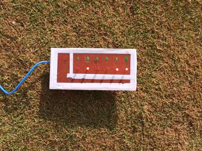
The LEDNet dataset consists of image data of a field area that are captured from a mobile phone camera.
Images in the dataset contain the information of an area where a PCB board is placed, containing 6 LEDs. Each state of the LEDs on the PCB board represents a binary number, with the ON state corresponding to binary 1 and the OFF state corresponding to binary 0. All the LEDs placed in sequence represent a binary sequence or encoding of an analog value.
- Categories:
736 ViewsThe emerging 5G services offer numerous new opportunities for networked applications. In this study, we seek to answer two key questions: i) is the throughput of mmWave 5G predictable, and ii) can we build "good" machine learning models for 5G throughput prediction? To this end, we conduct a measurement study of commercial mmWave 5G services in a major U.S. city, focusing on the throughput as perceived by applications running on user equipment (UE).
- Categories:
2212 Views
India is known for its highly disciplined foreign policies, strategic location, vibrant and massive Diaspora. India envisages enhancing its scope of cooperation, trade and widens its sphere of relations with the Pacific. As a result, the world is witnessing the rise of Indo-Pacific ties. Before the 1980’s the keystone of the universe was called the Atlantic, but now a radical shift to the east is noticed by the term “Indo-Pacific‟.
- Categories:
626 Views
YonseiStressImageDatabase is a database built for image-based stress recognition research. We designed an experimental scenario consisting of steps that cause or do not cause stress; Native Language Script Reading, Native Language Interview, Non-native Language Script Reading, Non-native Language Interview. And during the experiment, the subjects were photographed with Kinect v2. We cannot disclose the original image due to privacy issues, so we release feature maps obtained by passing through the network.
- Categories:
3415 Views
The DREAM (Data Rang or EArth Monitoring): a multimode database including optics, radar, DEM and OSM labels for deep machine learning purposes.
DREAM, is a multimodal remote sensing database, developed from open-source data.
The database has been created using the Google Earth Engine platform, the GDAL python library; the “pyosm” python package developed by Alexandre Mayerowitz (Airbus, France). If you want to use this dataset in your study, please cite:
- Categories:
801 Views
The data-set used in the paper titled "Short-Term Load Forecasting Using an LSTM Neural Network."
- Categories:
1590 Views