Geoscience and Remote Sensing

This dataset provides the high-resolution remote senisng data regarding various coastline scenes.
- Categories:
 301 Views
This folder contains folders of images.
The original folder contains the non dehazed images, default and tuned contain the dehazed counterparts.
Default folder referes to the outputs obtained using an exponent of 0.8.
Tuned refers to the images with a PSNRBR of 54 or above.
The images in paper are kept in a seperate folder.
- Categories:
36 Views

This file include Instrument lookup tables for EV8TOz algorithm use. It also inlcude sensor soft calibration tables.
- Categories:
59 Views
This dataset is about the manuscript "Density and Magnetization Vector Joint Inversion Method of Gravity and Magnetic Data With Tetrahedral Unstructured Grid and Its Application in the Huanggangliang–Ganzhuermiao Metallogenic Belt".
- Categories:
72 Views
This dataset contains support data for the manuscript "Parallel 3D Frequency Domain Electromagnetic Modeling based on Mesh Partitioning technique" submitted to TGRS.
- Categories:
75 Views
<p>Images from Sentinel 2 for dehazing. Contains 3 folders, one with original images, one with dehazed images at default exponent of 0.8 and the last with failed images with fine tuned exponent (thus becoming successful).</p>
- Categories:
21 Views
Drone based wildfire detection and modeling methods enable high-precision, real-time fire monitoring that is not provided by traditional remote fire monitoring systems, such as satellite imaging. Precise, real-time information enables rapid, effective wildfire intervention and management strategies. Drone systems’ ease of deployment, omnidirectional maneuverability, and robust sensing capabilities make them effective tools for early wildfire detection and evaluation, particularly so in environments that are inconvenient for humans and/or terrestrial vehicles.
- Categories:
17395 Views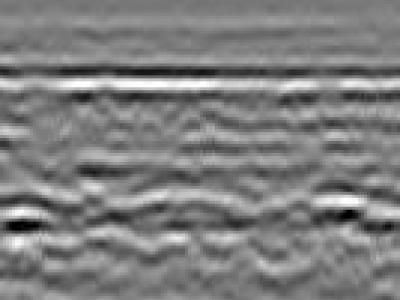
100 GPR images of expressways in China
- Categories:
40 Views
Ground Penetrating Radar (GPR) has a wide range of applications such as detection of buried mines, pipes and wires. GPR has been used as a near-surface remote sensing technique, and its working principle is based on electromagnetic (EM) wave theory. Here proposed data set is meant for data driven surrogate modelling based Buried Object Characterization. The considered problem of estimating geophysical parameters of a buried object is 2D. The training and testing scenarios include B-scan images (2D data), which contain 16 pairs of A-scan (concatenated forms of A-scans).
- Categories:
747 Views