Geoscience and Remote Sensing
100 GPR images of expressways in China
- Categories:
 97 Views
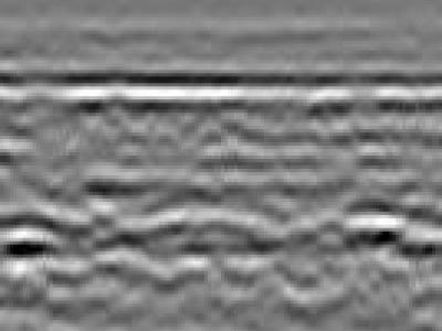
Ground Penetrating Radar (GPR) has a wide range of applications such as detection of buried mines, pipes and wires. GPR has been used as a near-surface remote sensing technique, and its working principle is based on electromagnetic (EM) wave theory. Here proposed data set is meant for data driven surrogate modelling based Buried Object Characterization. The considered problem of estimating geophysical parameters of a buried object is 2D. The training and testing scenarios include B-scan images (2D data), which contain 16 pairs of A-scan (concatenated forms of A-scans).
- Categories:
872 Views
The NENU-MPF dataset is a spatiotemporally continuous melt pond fraction (MPF) dataset of Arctic sea ice from 2000 to 2020 (from May 8 to September 24). It was generated from the Moderate Resolution Imaging Spectroradiometer (MODIS) data using an artificial neural network and a statistical-based temporal filter.
The NENU-MPF dataset was saved in a binary format (.img), which can be easily read by the ENVI software. The information about the data files can be found in the corresponding .hdr file.
- Categories:
152 Views
This is the experimental photo dataset of the article "An Automatic and Accurate Method for Marking GCPs in UAV Photogrammetry".
- Categories:
126 Views
Magnetotellurics forward modeling synthesizing time series
- Categories:
110 Views
Glacial lake outburst floods (GLOFs) are a major threat to the local communities and important infrastructures in the high mountain regions. Early detection of glacial lakes can prevent these disastrous events. Towards this end, we collected Sentinel 2 true color scenes of High-Mountain Asia (HMA) region using glacial lakes inventory of this region. It covers an area of 2080.12 km2 with nearly 30,121 glacial lakes. After data collection, we retained 1200 cloud free true color images and manually generated their ground truth masks.
- Categories:
2219 Views
The optical remote sensing (ORS) ship dataset contains eight ship classes (i.e., bulk carrier, car carrier, cargo, chemical tanker, container, dredge, oil tanker, tug) with a total of 8678 pictures. All pictures are collected using Google Earth with sub-meter resolution and corresponding class information are matched with the official website[http://www.marinetraffic.com/]
- Categories:
491 Views
The geological and hydrological pressures were generally neglected primarily due to the challenging nature of the monitoring task in an underwater setting, particularly over a large-scale region. Using repeated multibeam sonar measurements, we developed an uncertainty-based approach for interpreting the geomorphic change of the Lion City, an ancient Chinese city that is submerged in Qiandao lake.
- Categories:
117 Views
The geological and hydrological pressures were generally neglected primarily due to the challenging nature of the monitoring task in an underwater setting, particularly over a large-scale region. Using repeated multibeam sonar measurements, we developed an uncertainty-based approach for interpreting the geomorphic change of the Lion City, an ancient Chinese city that is submerged in Qiandao lake.
- Categories:
93 Views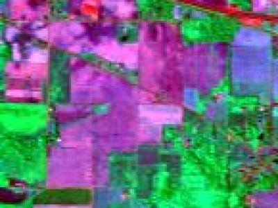
hyperspectral images including Indian Pines, Salinas and the University of Pavia.
- Categories:
841 Views