Agriculture
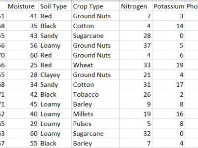
This dataset provides comprehensive data for predicting the most suitable fertilizer for various crops based on environmental and soil conditions. It includes environmental factors like temperature, humidity, and moisture, along with soil and crop types, and nutrient composition (Nitrogen, Potassium, and Phosphorous). The target variable is the recommended fertilizer name.
The data is already pre-processed without anu Null values.
- Categories:
 1675 Views
The dataset contains the ground-based observations of crop growth stages for Canada's prairie provinces (Manitoba, Saskatchewan and Alberta) from 2019 to 2020. Crop growth stages were visually observed from the side of the fields on a weekly cycle until the fields were harvested. The BBCH (Biologische Bundesanstalt, Bundessortenamt und CHemische Industrie) scale was used to stage growth.
- Categories:
 592 Views
The dataset provides crop-type surveys for Canada's prairie provinces (Manitoba, Saskatchewan and Alberta) in 2020 and 2021. The data were collected via windshield survey(driving through the countryside with GPS-enabled data collection software and satellite imagery). Crop-type points and their geographic coordinates on the ground were gathered using data collection software. Field boundaries were identified on satellite imagery. A single observation point is dropped in a homogeneous area within the field.
- Categories:
 335 Views
In this research, a newly modified UNet (Fast-UNet) was implemented to segment winter wheat from time series Sentinel-2 images for the years 2021 and 2023. These images were converted to NDVI and utilized to identify wheat fields by tracking the wheat phenology from sowing to harvesting. The main satellite image that was used in this research was Sentinel-2. It is considered important, and free optical remote sensing satellite data is provided by the European Space Agency (ESA). Sentinel-2A and Sentinel-2B were launched in June 2015 and March 2017, respectively.
- Categories:
 363 Views
This dataset webpage contains datasets of exisiting and proposed models:
- centrifugalpump1.zip
- centrifugalpump2.zip
- centrifugalpump3.zip
B Model of Fault And Short-Circuit Analysis of Centrifugal Pump
presented in my last Speaker Presentation in Conference - 2025*.
- Categories:
 395 Views
The study focused on two regions in Rupnagar district, India, with an area of 216 km² as shown in Fig. 1a, using satellite data from June to November 2023. The upper region predominantly features paddy and maize, while the lower region includes paddy and sugarcane. Satellite images were obtained from PlanetScope’s 130-satellite constellation, with a spatial resolution of 3 meter. A total of 32 images, captured between late May and mid-November 2023, were used, all with less than 15% cloud cover.
- Categories:
 196 Views
The dataset provides detailed information for wheat crop monitoring in the Karnal District, India, spanning the period from 2010 to 2022. It is divided into four main components. The first component, Remote Sensing Data, includes Sentinel-2 (10 m resolution) satellite data averaged over village boundaries, specifically over a wheat crop mask. This folder contains two Excel files: one for NDVI (Normalized Difference Vegetation Index) and another for NDWI (Normalized Difference Water Index), both providing fortnightly data during the Rabi season across a 10-year period.
- Categories:
 553 Views
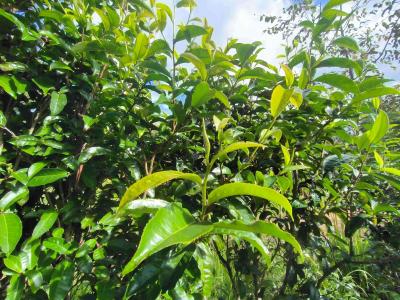
To solve the problem of accurate recognition and picking of tea by tea picking robot, this study proposes a S-YOLOv10-SIC algorithm that integrates slice-assisted hyper-inference algorithm. This algorithm enhances the YOLOv10 network by introducing Space-to-Depth Convolution, asymptotic feature pyramid network, and Inner-IoU. These improvements reduce the loss of detailed information in long-distance and low-resolution images, improve key layer saliency, optimize non-adjacent layer fusion, enhance model convergence speed, and increase model universality.
- Categories:
 419 Views
This dataset is designed for the reconstruction of images of underground potato tubers using received signal strength (RSS) measurements collected by a ZigBee wireless sensor network. It includes RSS data from sensing areas of various sizes, environments with different layouts, and soils with varying moisture levels. The measurements were obtained from 9 potato tubers of differing sizes and shapes, which were buried in two distinct positions within the sensing area.
- Categories:
 230 Views