Dataset Search

Displaying 529 - 552 of 8289 results

The HROS dataset consists of OPT and SAR images collected from multiple sources. The OPT images are collected from the large-scale public remote sensing datasets. Image sources include different platforms, including Google Maps, JL-1 satellite, Gaofen-2 satellite, aerial imagery, etc. The SAR images are captured by the AS-01 satellite, developed by Skysight Technology Co., LTD. The AS-01 satellite is equipped with a two-dimensional scanning plane solid-state active phased array synthetic aperture radar (SAR) payload, which enables high-resolution imaging capabilities.

Categories:

The dataset contains a series of experiments on Requirement Elicitation conducted at the Universidad Politécnica de Madrid between 2007 and 2016.

The research goal is to understand the impact of the problem domain and personal experience on the effectiveness of the requirements capture. The elicitation technique used was the unstructured interview. Sessions were limited to a short time (around 15 minutes, with exceptions). There were not follow-up interview sessions (with a unique exception).

Categories:

Vasculargraft failure rates remain unacceptably high due to thrombosis and poor integration, necessitating innovative solutions. This study optimized plant-derived extracellular matrix scaffolds as a scalable and biocompatible alternative to synthetic grafts and autologous vessels. We refined decellularization protocols to achieve >95% DNA removal while preserving mechanical properties comparable to native vessels, significantly enhancing endothelial cell seeding.

Categories:

This is a data for cosmetics dataset. The International Patent Classification (IPC) is a standardized, hierarchical system used worldwide to categorize the technical content of patents. It is administered by the World Intellectual Property Organization (WIPO). The IPC system breaks down technology into sections, classes, subclasses, and groups, each representing specific technical domains. By assigning IPC codes to patent documents, patent offices and researchers can systematically organize, search, and analyze patent information across various industries and technological fields.

Categories:

Defect pattern recognition (DPR) of wafer maps is critical for determining the root cause of production defects, which can provide insights for the yield improvement in wafer foundries. During wafer fabrication, several types of defects can be coupled together in a piece of wafer, it is called mixed-type defects DPR. To detect mixed-type defects is much more complicated because the combination of defects may vary a lot, from the type of defects, position, angle, number of defects, etc. Deep learning methods have been a good choice for complex pattern recognition problems.

Categories:

The MIT-Physio AFib ECG Database is a comprehensive integrated resource that combines two of the most frequently used datasets for atrial fibrillation research: the MIT‑BIH AFib Database and the PhysioNet/Computing in Cardiology Challenge 2017 dataset. This resource includes 25 long-term 10‑hour recordings with dual-channel ECG signals (recorded at 250 Hz with 12‑bit resolution over ±10 mV) as well as short single‑lead ECG recordings (ranging from 30 to 60 seconds at 300 Hz).

Categories:

MapData is a globally diverse dataset spanning 233 geographic sampling points. It offers original high-resolution images ranging from 7,000×5,000 to 20,000×15,000 pixels. After rigorous cleaning, the dataset provides 121,781 aligned electronic map–visible image pairs (each standardized to 512×512 pixels) with hybrid manual-automated ground truth—addressing the scarcity of scalable multimodal benchmarks.

Categories:

The dataset used in this paper contains a total of two , one is the bearing dataset from the University of Paderborn, which uses a total of five KA01,KA04,KA05,K003,KI01 and the author's laboratory self-built dataset, which is divided into a total of six, normal signals, turn-to-turn short circuits, rotor misalignments, rotor breaks, in-bearing damages, and out-of-bearing damages, and both of them use vibration signals as well as current signals were used to generate training as well as experiments.

Categories:

Endurance running is a popular activity due to its accessibility. However, participation is sometimes prevented by individuals experiencing respiratory problems. Monitoring breathing with body area networks can tackle these issues by tracking respiration during exercise and providing immediate, guiding feedback. Common breathing guidance systems rely on observational data from past breath cycles and consequently inherit disruptively lagging guidance interventions if breathing pattern suddenly change.

Categories:

We develop a geological and geophysical forward modeling workflow from the perspective of stratigraphic forward modeling, adding fold structures, building attribute models, building seismic data. Specifically, we first use PyBadlands (Salles et al., 2018) to simulate numerous stratigraphic layers under diverse forcing conditions. Then we perform the interpolation process to obtain a stratigraphic volume and add folding structures (Wu et al., 2020).

Categories:

<p>ImageNet is a large-scale visual database widely used in the field of computer vision, especially for object recognition tasks. It contains millions of labeled images, organized into multiple categories, and is used for training and evaluating image classification models. ImageNet datasets are widely used for training deep learning models, particularly Convolutional Neural Networks (CNNs). ILSVRC2012 (ImageNet Large Scale Visual Recognition Challenge 2012) is a part of ImageNet and is a competition for image classification and object detection.

Categories:

ImageNet is a large-scale visual database widely used in the field of computer vision, especially for object recognition tasks. It contains millions of labeled images, organized into multiple categories, and is used for training and evaluating image classification models. ImageNet datasets are widely used for training deep learning models, particularly Convolutional Neural Networks (CNNs).

Categories:

<p>ImageNet is a large-scale visual database widely used in the field of computer vision, especially for object recognition tasks. It contains millions of labeled images, organized into multiple categories, and is used for training and evaluating image classification models. ImageNet datasets are widely used for training deep learning models, particularly Convolutional Neural Networks (CNNs). ILSVRC2012 (ImageNet Large Scale Visual Recognition Challenge 2012) is a part of ImageNet and is a competition for image classification and object detection.

Categories:

Māori enterprises are pivotal to the economic and cultural prosperity of Aotearoa, yet predictive analysis of business outcomes tailored to these enterprises remains underexplored. This research examines the application of recurrent neural networks (RNNs) and transformer architectures to forecast key performance indicators (KPIs) for Māori small and medium-sized enterprises (SMEs).

Categories:

The experimental data in this paper comes from the Optimal Interpolation Sea Surface Temperature (OISST) data provided by the National Oceanic and Atmospheric Administration (NOAA). The data can be accessed at https://www.esrl.noaa.gov/psd/. The dataset includes daily mean sea surface temperature data from January 2010 to December 2020, with a spatial resolution of 0.25◦ × 0.25◦. We selected the datasets from the Bohai Sea and the South China Sea. Detailed information is provided in Table I.

Categories:

This dataset is constructed in a study that addresses the gap between text summarization and content readability for diverse Turkish-speaking audiences. It contains paired original texts and corresponding summaries optimized for different readability levels using the YOD (Yeni Okunabilirlik Düzeyi) formula.

Categories:

The Japan region is characterized by intense seismic activity. This catalog consists of earthquakes in a polygon bounded by 129°27'-144°73' E and 26°96'-43°04' N and from March 6, 2003, to July 10, 2023, obtained from the Japanese Meteorological Agency [1,2]. Aftershocks were identified using Molchan–Dmitrieva’s algorithm [3], which relies on the statistical analysis of the spatiotemporal distribution of seismic events. The aftershocks were subsequently marked using the program described in [4], which is an adaptation of the earlier program developed by Smirnov [5].

Categories:

We constructed the largest NAS package dataset to date, consisting of 1,489 NAS packages from major third-party sources, which can offer representative data for further research. Given that Synology and QNAP have the largest user bases, these platforms experience the highest frequency of attacks. Furthermore, the NAS package ecosystems provided by other vendors are considerably smaller. So our security measurements focus solely on the NAS packages of Synology and QNAP.

Categories:

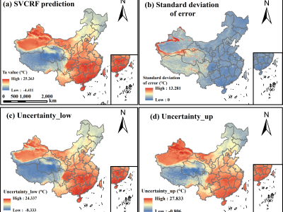
Accurately predicting spatially-continuous daily air temperature (Ta) is critical for agriculture, environmental management, and ecology. While meteorological stations provide precise Ta data, their spatial coverage is limited. Remotely-sensed Land Surface Temperature (LST), often fused with meteorological data, offers broader spatial coverage but struggles due to complex relationships between Ta and LST, influenced by factors like topography and human activities.

Categories:

<p class="MsoNormal"><span style="mso-spacerun: 'yes'; font-family: 宋体; mso-ascii-font-family: Calibri; mso-hansi-font-family: Calibri; mso-bidi-font-family: 'Times New Roman'; font-size: 10.5000pt; mso-font-kerning: 1.0000pt;"><span style="font-family: Calibri;">This dataset contains expert evaluations of various text features using Grey Relational Analysis (GRA), comparing the performance of original and new prompt words.

Categories:

This dataset comprises 32-bit floating-point SAR images in TIFF format, capturing coastal regions. It includes corresponding ground truth masks that differentiate between land and water areas. The covered regions include the Netherlands, London, Ireland, Spain, France, Lisbon, the USA, India, Africa, and Italy. The SAR images were acquired in Interferometric Wide (IW) mode with dual polarization at a spatial resolution of 10m × 10m.


Categories: