Remote Sensing
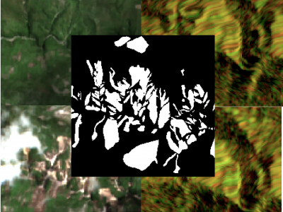
The detection of the collapse of landslides trigerred by intense natural hazards, such as earthquakes and rainfall, allows rapid response to hazards which turned into disasters. The use of remote sensing imagery is mostly considered to cover wide areas and assess even more rapidly the threats. Yet, since optical images are sensitive to cloud coverage, their use is limited in case of emergency response. The proposed dataset is thus multimodal and targets the early detection of landslides following the disastrous earthquake which occurred in Haiti in 2021.
- Categories:
 859 Views
Forest wildfires are one of the most catastrophic natural disasters, which poses a severe threat to both the ecosystem and human life. Therefore, it is imperative to implement technology to prevent and control forest wildfires. The combination of unmanned aerial vehicles (UAVs) and object detection algorithms provides a quick and accurate method to monitor large-scale forest areas.
- Categories:
1150 Views
Los Angeles-1: This dataset was also derived from the AVIRIS sensor with a 7.1-m spatial resolution. This image scene covers an area of 100 × 100 pixels, which has 205 spectral bands with the spectral wavelengths from 430 to 860 nm after bad bands are removed; 232 pixels are representing buildings are regarded as anomalies.
- Categories:
370 Views
The LuFI-RiverSnap dataset includes close-range river scene images obtained from various devices, such as UAVs, surveillance cameras, smartphones, and handheld cameras, with sizes up to 4624 × 3468 pixels. Several social media images, which are typically volunteered geographic information (VGI), have also been incorporated into the dataset to create more diverse river landscapes from various locations and sources.
Please see the following links:
- Categories:
632 Views
This dataset in conformed by hyperspectral images captured with the Fx10 camera. The images show the dissolutions of different concentrations of rhodamine. The Rhodamine Water Tracer, hereafter referred to as rhodamine, is a fluorescent dye primarily used as a tracer in aquatic environments. The rhodamine was purchased from ThermoFisher Scientific, identified by the chemical codes CAS 37299-86-8 and 7732-18-5, with catalogue number 446971000.
- Categories:
28 Views
Dataset Description
This dataset, named MultiSense, is designed to enhance disaster response by providing comprehensive data from multiple sources. It comes in two versions: balanced and unbalanced. The dataset consists of five distinct classes, each representing different types of events or conditions:
-
Syria Earthquake: This class includes imagery and video footage related to earthquake damage. The data captures the aftermath of seismic events, showcasing various degrees of destruction.
- Categories:
245 Views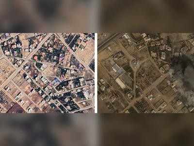
Designing practical algorithms for damage detection in satellite images requires a substantial and well-labeled dataset for training, validation, and testing. In this paper, we collect GAZADeepDav: a high-resolution PlanetScope satellite imagery dataset with 7264 tiles for no damage and 6196 tiles for damage . This work is delving into the steps of collecting the dataset, Geotagging and employing deep learning architectures to distinguish damage in war zones while also providing valuable insights for researchers undertaking similar tasks in real-world applications.
- Categories:
246 Views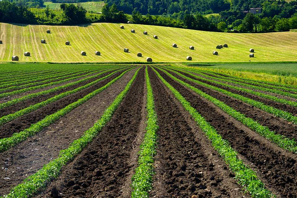
The utilization of unmanned aerial vehicle (UAV) remote sensing allows for fast and effective soil moisture content (SMC) monitoring. Scale conversion can obtain remote sensing images at multiple resolutions and offer the possibility of improving the estimation accuracy of SMC, which is significant for precision agriculture. To explore the effect of upscaling conversion on SMC monitoring with UAV remote sensing, multispectral images and SMC data at different soil depths were acquired.
- Categories:
267 Views
QiandaoEar22 is a high-quality noise dataset designed for identifying specific ships among multiple underwater acoustic targets using ship-radiated noise. This dataset includes 9 hours and 28 minutes of real-world ship-radiated noise data and 21 hours and 58 minutes of background noise data.
- Categories:
654 Views
As an artificial structure, tailings ponds exhibit regular geometric shapes and relatively straight dams in HRRSIs. Because the typical tailings dam is composed of an initial dam and successive accumulation dams, the tailings dam structure presents obvious linear stripe characteristics. The initial dam, constructed using sand, gravel, or concrete, has a bright color, while the color of the accumulation dam varies based on factors such as particle size, soil coverage, and vegetation restoration.
- Categories:
79 Views