Image Processing
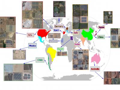
Extracting the boundaries of Photovoltaic (PV) plants is essential in the process of aerial inspection and autonomous monitoring by aerial robots. This method provides a clear delineation of the utility-scale PV plants’ boundaries for PV developers, Operation and Maintenance (O&M) service providers for use in aerial photogrammetry, flight mapping, and path planning during the autonomous monitoring of PV plants.
- Categories:
 1437 Views
Accurate information about crop rotation is essential for administrators, managers and various government departments for assessment, monitoring, and management of various resources for crop escalation. Radar remote sensing, because of its all-weather capability and assured uninterrupted data supply can show a substantial part in the evaluation of crop rotation.
- Categories:
909 Views
The endmembers of a hyperspectral image (HSI) are more likely to be generated by independent sources and be mixed in a macroscopic degree before arriving at the sensor element of the imaging spectrometer as mixed spectra.
- Categories:
549 Views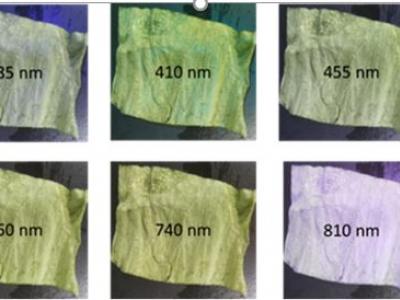
A custom made multispectral camera was used to collect a novel dataset of images of untreated lettuce leaves or leaves treated with vinegar, oil, or a combination of these. The camera captured image data at 10 wavelengths ∈[380nm,980nm] across the electromagnetic spectrum in the visible and NIR (near-infrared) regions. Imaging was done in a lab environment with the presence of ambient light.
- Categories:
465 Views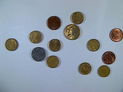
This dataset is a collection of images and their respective labels containing examples of multiple Brazilian coins, the primary purpose is to support the development of Computer Vision techniques for automatic detection of such objects, i.e., localization and classification tasks.
- Categories:
1420 Views
This dataset is used for arbitrary-orientation scene text detection, recognition and spotting.
- Categories:
223 Views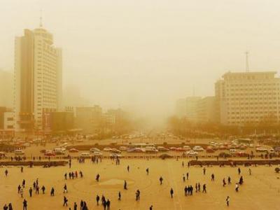
a example of sand dust image for test
- Categories:
1210 Views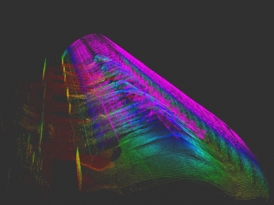
Dataset of rosbags collected during autonomous drone flight inside a warehouse of stockpiles. PCD files created using reconstruction method proposed by article.
Data still being move to IEEE-dataport.
- Categories:
1944 Views
The data files contains all the thermal images and error data of the spindle in the experiment.
- Categories:
416 Views
About
Dataset described in:
Daudt, R.C., Le Saux, B., Boulch, A. and Gousseau, Y., 2019. Multitask learning for large-scale semantic change detection. Computer Vision and Image Understanding, 187, p.102783.
This dataset contains 291 coregistered image pairs of RGB aerial images from IGS's BD ORTHO database. Pixel-level change and land cover annotations are provided, generated by rasterizing Urban Atlas 2006, Urban Atlas 2012, and Urban Atlas Change 2006-2012 maps.
The dataset is split into five parts:
- 2006 images
- Categories:
19441 Views