Artificial Intelligence
Multimodal sensor fusion has been widely adopted in constructing scene understanding, perception, and planning for intelligent robotic systems. One of the critical tasks in this field is geospatial tracking, i.e., constantly detecting and locating objects moving across a scene. Successful development of multimodal sensor fusion tracking algorithms relies on large multimodal datasets where common modalities exist and are time-aligned, and such datasets are not readily available.
- Categories:
 696 Views
Cora, Citeseer, and Pubmed are three citation networks for research papers, where nodes represent publications and edges denote citation links. Node attributes consist of bag-of-words representations of the papers.
ACM is a paper network where nodes represent papers connected by edges if two papers share the same author. The network is characterized by features that include bagof- words representations of paper keywords.
- Categories:
 81 Views
This figure shows the accuracy and loss curves generated during the training process. We trained different neural networks on the CIFAR-100 dataset. For each network, the same training strategy was applied to every image in the dataset. The blue curve represents the accuracy after replacing the convolution layers, which achieves a higher accuracy compared to other networks.In the figure, the green curve represents the network after replacing standard convolution with the SCT module.
- Categories:
 66 Views
The Theory of Integrated Language Learning (ToILL) supports many complementary schools of educational thought. The constructivism, pragmatism, humanism, and sociocultural theory are combined in one process to produce an integrated and successful method of language acquisition. The approach promotes the complete person development in a continuously changing environment that is global in nature but does not stop at cognitive components but also concerns the social and emotional experiences of the students.
- Categories:
 258 Views
The DRIVE dataset, developed by Staal et al. (2004), utilizes the elongated structure of vessel ridges for automatic vessel classification in the Utrecht database. It consists of 40 images (565 × 584 pixels) in JPEG format, captured at a 45° field of view, divided into 20 training and 20 testing images.
- Categories:
 69 Views
This dataset originates from a longitudinal study examining the factors contributing to the progression of cardiovascular disease. P This particular research employs the unprocessed sequential actigraph recordings collected from an actigraph device. We evaluate sleep quality based on the two indicators as proposed in our previous study [3] which are weekly sleep quality ‘SleepQualWeek’, and sleep consistency ‘SleepCons’. SleepQualWeek and SleepCons are calculated using the pre-processed attribute set derived from the MESA dataset.
- Categories:
 187 Views
The increasing prevalence of encrypted traffic in
modern networks poses significant challenges for network security,
particularly in detecting and classifying malicious activities
and application signatures. To overcome this issue, deep learning
has turned out to be a promising candidate owing to its ability
to learn complex data patterns. In this work, we present a
deep learning-based novel and robust framework for encrypted
traffic analysis (ETA) which leverages the power of Bidirectional
- Categories:
 196 Views
This dataset is from "One-Stage Cascade Refinement Networks for Infrared Small Target Detection." It includes 427 infrared images and 480 targets (due to the lack of infrared sequences, SIRST also contains infrared images at a wavelength of 950 nm, in addition to shortwave and midwave infrared images). Approximately 90% of the images contain only one target, while about 10% have multiple targets (which may be overlooked in sparse/significant methods due to global unique assumptions).
- Categories:
 131 Views
This custom dataset was created to support gait recognition research using Inertial Measurement Units (IMUs), which capture acceleration, angular velocity, and orientation data from key body locations (e.g., ankles, waist, wrists). It includes recordings from [insert number] participants performing various walking tasks under different conditions, such as normal and fast walking or navigating obstacles. The dataset provides time-series data suitable for both traditional feature-based analysis and deep learning approaches.
- Categories:
 119 Views
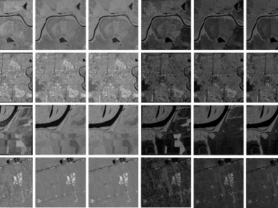
When training supervised deep learning models for despeckling SAR images, it is necessary to have a labeled dataset with pairs of images to be able to assess the quality of the filtering process. These pairs of images must be noisy and ground truth. The noisy images contain the speckle generated during the backscatter of the microwave signal, while the ground truth is generated through multitemporal fusion operations. In this paper, two operations are performed: mean and median.
- Categories:
 654 Views


