Computer Vision

We propose a novel high-resolution dataset named, “Dataset for Indian Road Scenarios (DIRS21)” for developing perception systems for advanced driver assistance systems.
- Categories:
 4488 Views
Opportunity++ is a precisely annotated dataset designed to support AI and machine learning research focused on the multimodal perception and learning of human activities (e.g. short actions, gestures, modes of locomotion, higher-level behavior).
- Categories:
1571 Views
We design a solution to achieve coordinated localization between two unmanned aerial vehicles (UAVs) using radio and camera perception. We achieve the localization between the UAVs in the context of solving the problem of UAV Global Positioning System (GPS) failure or its unavailability. Our approach allows one UAV with a functional GPS unit to coordinate the localization of another UAV with a compromised or missing GPS system. Our solution for localization uses a sensor fusion and coordinated wireless communication approach.
- Categories:
485 Views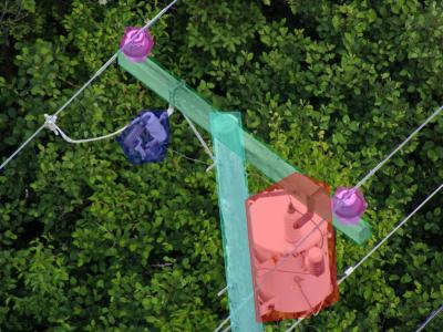
There is an industry gap for publicly available electric utility infrastructure imagery. The Electric Power Research Institute (EPRI) is filling this gap to support public and private sector AI innovation. This dataset consists of ~30,000 images of overhead Distribution infrastructure. These images have been anonymized, reviewed, and .exif image-data scrubbed. EPRI intends to label these data to support its own research activities. As these labels are created, EPRI will periodically update this dataset with those data.
Update: July 2022
- Categories:
2293 Views
To study the driver's behavior in real traffic situations, we conducted experiments using an instrumented vehicle, which comprises:
(i) a camera, installed above the vehicle's side window and oriented toward the driver, and (ii) a Mobile Digital Video Recorder (MDVR).
- Categories:
3657 Views
Surveillance video captured by Multi-intensity infrared illuminator.
GT(ground-truths) :bounding boxes of 'person' in channel 2,4 and 6 by following the Pascal VOC format.
- Categories:
751 Views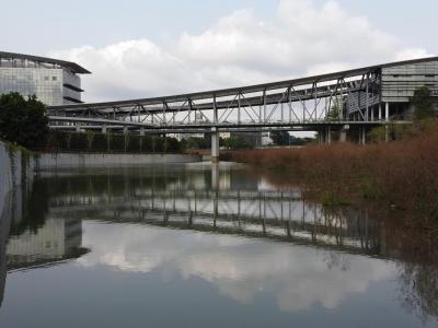
The Dasha River dataset was collected by a USV sailing along the Dasha River in Shenzhen, China. Visual images in the dataset were extracted from two videos taken from a USV perspective, with a resolution of 1920×1080 pixels. Totally 360 images were obtained after screening, and all labels were manually annotated.
- Categories:
343 Views
A new generation of computer vision, namely event-based or neuromorphic vision, provides a new paradigm for capturing visual data and the way such data is processed. Event-based vision is a state-of-art technology of robot vision. It is particularly promising for use in both mobile robots and drones for visual navigation tasks. Due to a highly novel type of visual sensors used in event-based vision, only a few datasets aimed at visual navigation tasks are publicly available.
- Categories:
1156 Views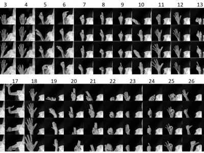
Computer vision systems are commonly used to design touch-less human-computer interfaces (HCI) based on dynamic hand gesture recognition (HGR) systems, which have a wide range of applications in several domains, such as, gaming, multimedia, automotive, home automation. However, automatic HGR is still a challenging task, mostly because of the diversity in how people perform the gestures. In addition, the number of publicly available hand gesture datasets is scarce, often the gestures are not acquired with sufficient image quality, and the gestures are not correctly performed.
- Categories:
9957 Views
(Work in progress)
This dataset contains the augmented images and the images & segmentation maps for seven handwashing steps, six of which are prescirbed WHO handwashing steps.
This work is based on a sample handwashing video dataset uploaded by Kaggle user real-timeAR.
- Categories:
339 Views