GeoTiff

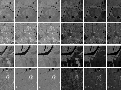
When training supervised deep learning models for despeckling SAR images, it is necessary to have a labeled dataset with pairs of images to be able to assess the quality of the filtering process. These pairs of images must be noisy and ground truth. The noisy images contain the speckle generated during the backscatter of the microwave signal, while the ground truth is generated through multitemporal fusion operations. In this paper, two operations are performed: mean and median.

Categories:
604 Views

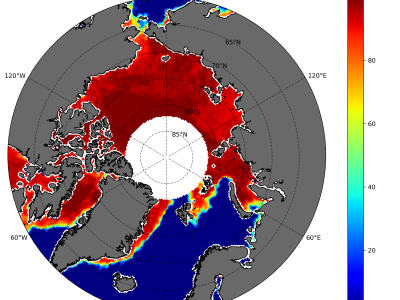
Sea ice concentration is important because it helps in determining important climate variables. Together with sea ice thickness, important fluxes between air and sea as well as heat transfer between the atmosphere can be determined. We designed an adapted bootstrap algorithm called SARAL/AltiKa Sea Ice Algorithm (SSIA) with some tunings and segregated the algorithm into winter and summer algorithms to estimate daily sea ice concentration (SIC) in the Arctic.

Categories:
182 Views

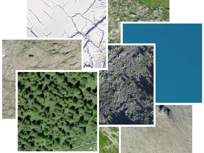
Our large scale alpine land cover dataset consists of  229'535 very high-resolution aerial images (50cm) and  digital elevation model (50cm) with land cover annotations  produced by  experts in photo-interpretration . The nine land cover types in our study area include bedrock, bedrock with grass, large blocks, large blocks with grass, scree, scree with grass, water area, forest and glacier. The distribution of pixels among classes presents a typical case of a long-tailed distribution with an imbalance factor, defined as the ratio of the most frequent to the rarest class, close to 1000.

Categories:
250 Views

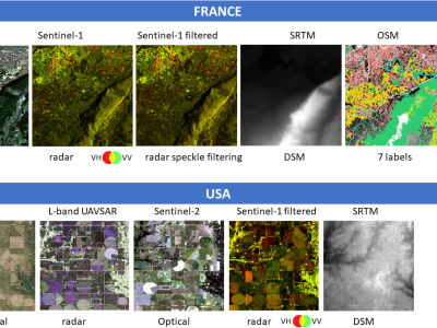
The DREAM (Data Rang or EArth Monitoring): a multimode database including optics, radar, DEM and OSM labels for deep machine learning purposes.

DREAM, is a multimodal remote sensing database, developed from open-source data.

The database has been created using the Google Earth Engine platform, the GDAL python library; the “pyosm” python package developed by Alexandre Mayerowitz (Airbus, France). If you want to use this dataset in your study, please cite:

Categories:
766 Views

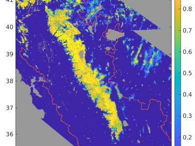
The files here support the analysis presented in the paper in IEEE Transactions on Geoscience and Remote Sensing, "Snow Property Inversion from Remote Sensing (SPIReS): A Generalized Multispectral Unmixing Approach with Examples from MODIS and Landsat 8 OLI" Spectral mixture analysis has a history in mapping snow, especially where mixed pixels prevail. Using multiple spectral bands rather than band ratios or band indices, retrievals of snow properties that affect its albedo lead to more accurate estimates than widely used age-based models of albedo evolution.

Categories:
279 Views

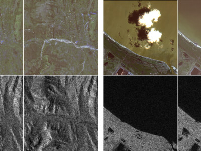
These last decades, Earth Observation brought quantities of new perspectives from geosciences to human activity monitoring. As more data became available, artificial intelligence techniques led to very successful results for understanding remote sensing data. Moreover, various acquisition techniques such as Synthetic Aperture Radar (SAR) can also be used for problems that could not be tackled only through optical images. This is the case for weather-related disasters such as floods or hurricanes, which are generally associated with large clouds cover.

Categories:
12222 Views

This dataset contains multispectral high resolution 1627 image patches of size 10 x 10 pixels with each pixel size of 10mx10m. These patches are generated from the Sentinel-2 (A/B) satellite images acquired during the period of October 2018 to May 2019. It covered one life cycle (12 months) of the sugarcane crop in the region of the Karnataka, India. Many parameters like plantation season, soil type, plantation type, crop variety and irrigation type that affects the growth of the sugarcane crop are considered while generating the samples.

Categories:
1951 Views

The Contest: Goals and Organization


The 2017 IEEE GRSS Data Fusion Contest, organized by the IEEE GRSS Image Analysis and Data Fusion Technical Committee, aimed at promoting progress on fusion and analysis methodologies for multisource remote sensing data.


Categories:
1812 Views

The Data Fusion Contest 2016: Goals and Organization

The 2016 IEEE GRSS Data Fusion Contest, organized by the IEEE GRSS Image Analysis and Data Fusion Technical Committee, aimed at promoting progress on fusion and analysis methodologies for multisource remote sensing data.

New multi-source, multi-temporal data including Very High Resolution (VHR) multi-temporal imagery and video from space were released. First, VHR images (DEIMOS-2 standard products) acquired at two different dates, before and after orthorectification:

Categories:
2087 Views