Remote Sensing
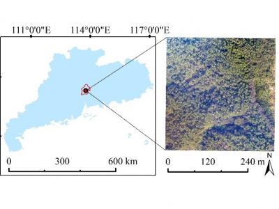
Location map of study area
- Categories:
 Views
ViewsLocation map of study area
- Categories:
100 ViewsLocation map of study area
- Categories:
Views
This file contains VLC RSSI data from the IoRL Measurement campaign.
The processing files included are developed by Ben Meunier from Brunel University London.
- Categories:
331 Views
Nothing
- Categories:
358 Views
The following data is accumulated zonal mean statistic for Pune city representing the time series of satellite data for Landsat, EBBI, NDVI, Wind Speed and Direction, MODIS day and night time LST observations.
- Categories:
88 Views
A synthetic signal dataset of 12 different modulations (including PSK, QPSK, 8PSK, QFSK, 8FSK, 16APSK, 16QAM, 64QAM, 4PAM, LFM, DSB-SC, and SSBSC) with different DOAs (discrete angles ranging from -60° to 60° with the step size of 1°) is generated using MATLAB 2021a. Regarding the signal model configuration for the data generation, we specify a uniform linear antenna array of M = 5 elements to acquire incoming signals having N = 1024 envelope complex samples, thus conducting an I/Q data array of size 1024 × 2 × 5.
- Categories:
3404 Views
A long-strip synthetic aperture radar interferometric (InSAR) measurement based on multiframe image mosaicking is currently the realizable approach to measure large-range ground deformation. As the spatial range of the mosaicked images increases, the degree of ground effects are more significant, and using empirical global ocean tidal models or plane fitting to correct the OTL displacement will produce large errors in a region with a complex coastline.
- Categories:
99 Views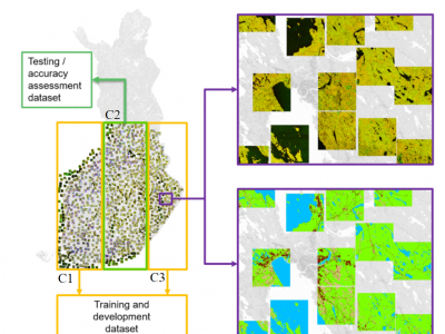
Here, a dataset used in manuscript "Wide-Area Land Cover Mapping with Sentinel-1 Imagery using Deep Learning Semantic Segmentation Models" Scepanovic et al. (https://doi.org/10.1109/JSTARS.2021.3116094) is published. The data contains preprocessed SAR backscatter digital numbers as 7000 geotiff image patches of size 512x512 (about 10 km x 10 km size) sampled from several wide-area SAR mosaics compiled from all summer Sentinel-1A images acquired over Finland in the summer of 2018.
- Categories:
681 Views
ABSTRACT
Europe is covered by distinct climatic zones which include semiarid, the Mediterranean, humid subtropical, marine,
humid continental, subarctic, and highland climates. Land use and land cover change have been well documented in the
past 200 years across Europe1where land cover grassland and cropland together make up 39%2. In recent years, the
agricultural sector has been affected by abnormal weather events. Climate change will continue to change weather
- Categories:
498 Views