Artificial Intelligence
The operator controls the vehicle to drive in the environment with dense distribution of obstacles, collects the spatial environment data through LIDAR and camera in the process of driving, and then processes the exercisable area map according to the change of longitudinal gradient, which is used to display the distribution of exercisable area in the current driving space of the vehicle, and then carries out the research of humanoid driving according to the distribution of the exercisable area and the data of driving behaviors.
- Categories:
 74 Views
The operator controls the vehicle to drive in the environment with dense distribution of obstacles, collects the spatial environment data through LIDAR and camera in the process of driving, and then processes the exercisable area map according to the change of longitudinal gradient, which is used to display the distribution of exercisable area in the current driving space of the vehicle, and then carries out the research of humanoid driving according to the distribution of the exercisable area and the data of driving behaviors.
- Categories:
 Views
Views
The study included 50 epilepsy patients undergoing long-term video-EEG monitoring at the Epilepsy Center of Guangdong 999 Brain Hospital. The inclusion criteria for patients were as follows: (1) VEEG reports confirming definite epileptic seizures, (2) complete video data containing both seizure and non-seizure periods, (3) no intentional interference during patient seizures, and no occlusion of the patient, such as patients were covered by quilts.
- Categories:
 45 Views
The dataset encompasses a diverse array of electrical signals representing Power Quality Disturbances (PQD), both in single and combined forms, meticulously generated in adherence to the IEEE 1159 guideline. Crucially, the dataset includes both raw data and corresponding labels, facilitating supervised learning tasks and enabling the development and evaluation of classification algorithms.
- Categories:
 1166 Views
Our DeepCoAST dataset specifically explores the vulnerabilities of various traffic-splitting Website Fingerprinting (WF) Defenses, such as TrafficSliver, HyWF, and CoMPS. Our dataset comprises defended traces generated from the BigEnough dataset, which includes Tor cell trace instances of 95 websites, each represented by 200 instances collected under the standard browser security level. We simulated the traffic-splitting defenses assuming there are two split traces from the vanilla trace.
- Categories:
 52 Views
The safe implementation and adoption of Autonomous Vehicle (AV) vision models on public roads requires not only an understanding of the natural environment comprising pedestrians and other vehicles but also the ability to reason about edge situations such as unpredictable maneuvers by other drivers, impending accidents, erratic movement of pedestrians, cyclists, and motorcyclists, animal crossings, and cyclists using hand signals.
- Categories:
 86 Views
This dataset contains both the artificial and real flower images of bramble flowers. The real images were taken with a realsense D435 camera inside the West Virginia University greenhouse. All the flowers are annotated in YOLO format with bounding box and class name. The trained weights after training also have been provided. They can be used with the python script provided to detect the bramble flowers. Also the classifier can classify whether the flowers center is visible or hidden which will be helpful in precision pollination projects.
- Categories:
 386 Views
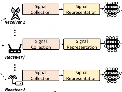
Radio frequency fingerprint identification (RFFI) is an emerging device authentication technique, which exploits the hardware characteristics of the RF front-end as device identifiers. The receiver hardware impairments interfere with the feature extraction of transmitter impairments, but their effect and mitigation have not been comprehensively studied. In this paper, we propose a receiver-agnostic RFFI system by employing adversarial training to learn the receiver-independent features.
- Categories:
 411 Views
This is the relevant data in "Monocular Homography Estimation and Positioning Method for the Spatial-Temporal Distribution of Vehicle Loads Identification".
- Categories:
 125 Views
The public UA-DETRAC data set was used to train the vehicle target detection model in this study. This data set was captured predominantly in the Beijing-Tianjin-Hebei area. Using a Canon EOS 550 camera, 10 hours of video were captured at 25 frames per second, and then the footage was processed. Each frame had a resolution of 960*540 pixels. The UA-DETRAC data set contained 8,259 manually labeled vehicles, with a total of 1,210,000 labeled vehicles. The labeled types included cars, buses, trucks, etc.
- Categories:
 655 Views


