Radio Frequency Interference
Jamming devices present a significant threat by disrupting signals from the global navigation satellite system (GNSS), compromising the robustness of accurate positioning. The detection of anomalies within frequency snapshots is crucial to counteract these interferences effectively. A critical preliminary measure involves the reliable classification of interferences and characterization and localization of jamming devices.
- Categories:
 257 Views
Jamming devices pose a significant threat by disrupting signals from the global navigation satellite system (GNSS), compromising the robustness of accurate positioning. Detecting anomalies in frequency snapshots is crucial to counteract these interferences effectively. The ability to adapt to diverse, unseen interference characteristics is essential for ensuring the reliability of GNSS in real-world applications. We recorded a dataset with our own sensor station at a German highway with two interference classes and one non-interference class.
- Categories:
 296 Views
Interference signals degrade and disrupt Global Navigation Satellite System (GNSS) receivers, impacting their localization accuracy. Therefore, they need to be detected, classified, and located to ensure GNSS operation. State-of-the-art techniques employ supervised deep learning to detect and classify potential interference signals. We fuse both modalities only from a single bandwidth-limited low-cost sensor, instead of a fine-grained high-resolution sensor and coarse-grained low-resolution low-cost sensor.
- Categories:
 450 Views
Jamming devices pose a significant threat by disrupting signals from the global navigation satellite system (GNSS), compromising the robustness of accurate positioning. Detecting anomalies in frequency snapshots is crucial to counteract these interferences effectively. The ability to adapt to diverse, unseen interference characteristics is essential for ensuring the reliability of GNSS in real-world applications. We recorded a dataset with our own sensor station at a German highway with eight interference classes and three non-interference classes.
- Categories:
 210 Views
Radio Frequency (RF) signals transmitted by Global Navigation Satellite Systems (GNSS) are exploited as signals of opportunity in many scientific activities, ranging from sensing waterways and humidity of the terrain to the monitoring of the ionosphere. The latter can be pursued by processing the GNSS signals through dedicated ground-based monitoring equipment, such as the GNSS Ionospheric Scintillation and Total Electron Content Monitoring (GISTM) receivers.
- Categories:
 227 Views
Interference signals degrade the performance of a global navigation satellite system (GNSS) receiver. Detection and classification of these interference signals allow better situational awareness and facilitate appropriate countermeasures. However, classification is challenging and processing-intensive, especially in severe multipath environments. This dataset is the result of a proposal for a low-resource interference detection and classification approach that combines conventional statistical signal processing approaches with machine learning (ML).
- Categories:
 464 Views
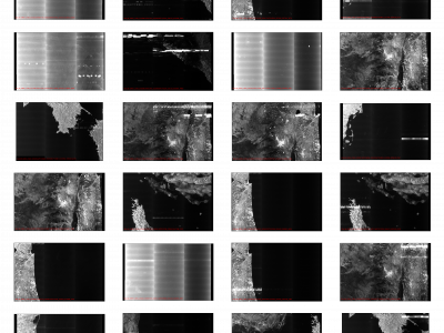
Synthetic Aperture Radar (SAR) satellite images are used increasingly more for Earth observation. While SAR images are useable in most conditions, they occasionally experience image degradation due to interfering signals from external radars, called Radio Frequency Interference (RFI). RFI affected images are often discarded in further analysis or pre-processed to remove the RFI.
- Categories:
 330 Views

