SAR
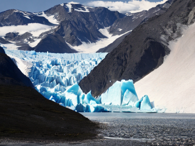
The temporal variability in calving front positions of marine-terminating glaciers permits inference on the frontal ablation. Frontal ablation, the sum of the calving rate and the melt rate at the terminus, significantly contributes to the mass balance of glaciers. Therefore, the glacier area has been declared as an Essential Climate Variable product by the World Meteorological Organization. The presented dataset provides the necessary information for training deep learning techniques to automate the process of calving front delineation.
- Categories:
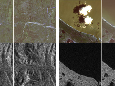
These last decades, Earth Observation brought quantities of new perspectives from geosciences to human activity monitoring. As more data became available, artificial intelligence techniques led to very successful results for understanding remote sensing data. Moreover, various acquisition techniques such as Synthetic Aperture Radar (SAR) can also be used for problems that could not be tackled only through optical images. This is the case for weather-related disasters such as floods or hurricanes, which are generally associated with large clouds cover.
- Categories:
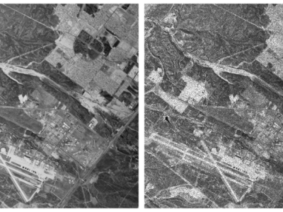
Synthetic Aperture Radar (SAR) images can be extensively informative owing to their resolution and availability. However, the removal of speckle-noise from these requires several pre-processing steps. In recent years, deep learning-based techniques have brought significant improvement in the domain of denoising and image restoration. However, further research has been hampered by the lack of availability of data suitable for training deep neural network-based systems. With this paper, we propose a standard synthetic data set for the training of speckle reduction algorithms.
- Categories:
PS_DISP is a trial bundled script written on bash shell and Matlab code. The script requires Generic Mapping Tools (GMT) and Matlab Software and runs under Linux operating system. The purpose of PS DISP is to generate 2D or 3D vectors displacement from InSAR both ascending and descending orbit either from the mean velocity or time-series data. The 1.5 beta version includes the computation of the 3D field using an optimized approach with variance component estimation (VCE).
- Categories:
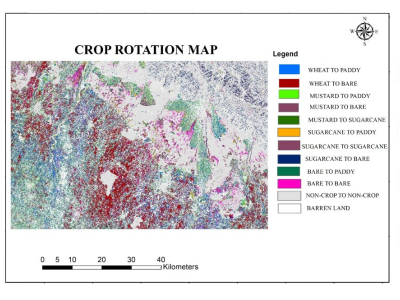
Accurate information about crop rotation is essential for administrators, managers and various government departments for assessment, monitoring, and management of various resources for crop escalation. Radar remote sensing, because of its all-weather capability and assured uninterrupted data supply can show a substantial part in the evaluation of crop rotation.
- Categories:
In tropical/subtropical regions, the favorable climate associated with the use of agricultural technologies, such as no-tillage, minimum cultivation, irrigation, early varieties, desiccants, flowering inducing and crop rotation, makes agriculture highly dynamic. In this paper, we present the Campo Verde agricultural database. The purpose of creating and sharing these data is to foster advancement of remote sensing technology in areas of tropical agriculture, primarily the development and testing of methods for crop recognition and agricultural mapping.
- Categories:
Synthetic Aperture Radar is a monitoring solution which is especially well fitted to maritime surveillance. The large swath widths, time-independent, weather resistant observations can be very useful for the detection of ships typically invisible to other forms of monitoring. A dataset which contains 43 Sentinel-1 Extended Wide Swath images and 3 RADARSAT-2 ScanSAR Narrow images between the 6th October 2014 to the 22 July 2015 is described and presented here.
- Categories: