CRAWDAD

Image
Additional Description

These datasets are part of Community Resource for Archiving Wireless Data (CRAWDAD). CRAWDAD began in 2004 at Dartmouth College as a place to share wireless network data with the research community. Its purpose was to enable access to data from real networks and real mobile users at a time when collecting such data was challenging and expensive. The archive has continued to grow since its inception, and starting in summer 2022 is being housed on IEEE DataPort.

Questions about CRAWDAD? See our CRAWDAD FAQ. Interested in submitting your dataset to the CRAWDAD collection? Get started, by submitting an Open Access Dataset.

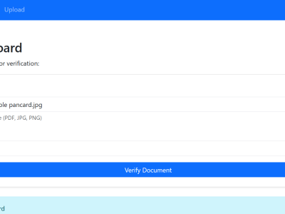
In today’s digital ecosystem, verifying the authenticity of identity documents is essential for secure access control and digital trust. Sectors such as finance, education, government, and employment frequently rely on scanned or digital versions of documents like Aadhaar cards, PAN cards, Voter IDs, Driving Licenses, and Passports. However, this convenience introduces risks related to document forgery and fraudulent activity.

Categories:

With the advent of 6G Open-RAN architecture, multiple operational services can be simultaneously executed in RAN, leveraging the near-Real-Time Radio Intelligent Controller (near-RT-RIC) and real-time (RT) nodes. The architecture provides an ideal platform for Federated Learning (FL): The xAPP is hosted in the near-RT-RIC to perform global aggregation, whereas the Open Radio Unit (ORU) allocates power to users to participate in FL in a RT manner. This paper identifies power and latency optimization as critical factors for enhancing FL in a stochastic environment.

Categories:

This dataset contains a list of Australian government domains (dedicated to the general population and indigenous people of Australia) collected through our research. We queried these domains to retrieve their NS records (labeled as NS_LVL1) and identified the DNS provider companies using Whois. Subsequently, we queried the NS_LVL1 domains to obtain their name servers (labeled as NS_LVL2) and determined their provider names. Using the list of DNS providers in Australia, we then used IP location to find the geolocation of these DNS providers.

Categories:

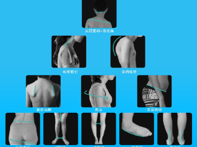
A poor posture is a common health issue for adolescents during their growth and development. A prolonged poor posture can lead to musculoskeletal pain and disorders, and may even affect adolescents' growth and development. However, it is time-consuming and subjective to assess the poor posture in adolescents. Thus it is crucial to obtain an accurate and rapid evaluation method for poor posture. 

Categories:

UPMVM used three datasets named UD1, UD2 and UD3. UD1 is primarily used to collect and retrieve 280 poetry meters (rhythmic patterns [بحر]) and their corresponding feet. Other uses of this dataset include the design of DFA state function sequences with terminal state information to align the identified verse meters. UD2 is collected from [GitHub - sayedzeeshan/Aruuz] and updated. This update process involves the parsing and tokenization of the UD2 dataset.

Categories:

Routing methods on wireless network topology face unstable packet delivery and low resources, so many possibilities when reconstructing its topology has been neglected. This caused huge traffic at nodes on topology’s best links, furthermore even those good nodes’ electricity consumption tear down too soon. Recently, these problems are gradually improving, thus this technical enhancement brought IoT into smart-home technology. However, RPL (Routing Protocols for Low) is still not recommended for them since its traffic burst makes its link reliability extremely poor.

Categories:

The SA dataset is a small- to medium-sized dataset that we collected and produced in 2023 for anemone image generation, primarily from EUVP, Flicker, and YouTube, and we consider the availability of the SA dataset to be of particular significance given the scarcity of marine life image datasets. Currently, we have not publicly released the SA dataset, but will do so in the near future.

Categories:

The "RF Jamming Dataset for Vehicular Wireless Networks" presents a comprehensive collection of data used in the research paper titled "RF Jamming Classification Using Relative Speed Estimation in Vehicular Wireless Networks." This dataset comprises diverse scenarios of RF jamming attacks and interference in Vehicular Ad-hoc Networks (VANETs), along with corresponding ground truth labels. The dataset is designed to support the evaluation and development of detection algorithms for RF jamming attacks in VANETs.

Categories:

The dataset contained walking data of 41 volunteers, including 20 women and 21 men. Each volunteer walked on asphalt and SLATE roads for six times, each time for less than one minute. In addition, the dataset also included gait data on stairs and stairs. The data acquisition frequency is 100HZ, and a total of four sensors are used to collect data. The sensor numbered 001 is located on the left knee, the sensor numbered 001 is located on the right wrist, the sensor numbered 003 is located on the left ankle, and the sensor 004 is located on the back of the waist.

Categories:

With the rapid increase in demand for fresh products, cold chain logistics has become an important mode of transportation. Logistics enterprises are faced with the problem of cost control and improvement of customer satisfaction. In light of this, we present a bi-objective optimization vehicle routing problem model in cold chain logistics, which aims to reduce the total costs and improve customer satisfaction.

Categories: