Image Processing

Light-matter interactions within indoor environments are significantly depolarizing. Nonetheless, the relatively small polarization attributes are informative. To make use of this information, polarized-BRDF (pBRDF) models for common indoor materials are sought. Fresnel reflection and diffuse partial polarization are popular terms in pBRDF models, but the relative contribution of each is highly material-dependent and changes based on scattering geometry and albedo.
- Categories:
 150 Views
Recognizing and categorizing banknotes is a crucial task, especially for individuals with visual impairments. It plays a vital role in assisting them with everyday financial transactions, such as making purchases or accessing their workplaces or educational institutions. The primary objectives for creating this dataset were as follows:
- Categories:
341 Views
This dataset contains video-clips of five volunteers developing daily life activities. Each video-clip is recorded with a Far InfraRed (FIR) camera and includes an associated file which contains the three-dimensional and two-dimensional coordinates of the main body joints in each frame of the clip. This way, it is possible to train human pose estimation networks using FIR imagery.
- Categories:
533 Views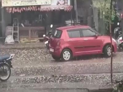
We present RRODT, a real-world rainy video dataset for testing the efficacy of deraining methods to help downstream object detection and object tracking. RRODT is composed of 57 videos and totally 10258 frames. It consists of two kinds of annotations. One set of annotation contains 33077 objects for detection. The other set contains 408 unique objects for tracking.
- Categories:
16 Views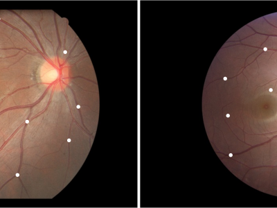
Fundus Image Myopia Development (FIMD) dataset contains 70 retinal image pairs, in which, there is obvious myopia development between each pair of images. In addition, each pair of retinal images has a large overlap area, and there is no other retinopathy. In order to perform a reliable quantitative evaluation of registration results, we follow the annotation method of Fundus Image Registration (FIRE) dataset [1] to label control points between the pair of retinal images with the help of experienced ophthalmologists. Each image pair is labeled with
- Categories:
543 Views
This dataset contains the Supplementary Information of the article "Discovering Mathematical Patterns Behind HIV-1 Genetic Recombination: a new methodology to identify viral features" (Manuscript DOI: 10.1109/ACCESS.2023.3311752).
- Categories:
310 Views
SYPHAXAR dataset is a dataset for Arabic text detection in the wild. It was collected from Tunisia in “Sfax” city, the second largest Tunisian city after the capital. A total of 3078 images were gathered through manual collection one by one, with each image energizing text detection challenges in nature according to real existing complexity of 15 different routes along with ring roads, intersections and roundabouts. These annotated images consist of more than 31000 objects, each of which is enclosed within a bounding box.
- Categories:
255 Views
Point cloud streaming has recently attracted research attention as it has the potential to provide six degrees of freedom movement, which is essential for truly immersive media. The transmission of point clouds requires high-bandwidth connections, and adaptive streaming is a promising solution to cope with fluctuating bandwidth conditions. Thus, understanding the impact of different factors in adaptive streaming on the Quality of Experience (QoE) becomes fundamental. Point clouds have been evaluated in Virtual Reality (VR), where viewers are completely immersed in a virtual environment.
- Categories:
114 Views

The "Paddy Field Dataset Captured in Palakkad District, Kerala, India" is a comprehensive collection of geospatial and attribute data specifically focused on paddy cultivation within the Palakkad district of the Kerala state in India. This dataset encompasses a wide range of information related to paddy fields, including their spatial distribution, size, crop varieties cultivated, land management practices, and relevant contextual factors. Geographic Information System (GIS) technology has captured accurate geospatial coordinates, enabling precise mapping and analysis.
- Categories:
1065 Views