
The dataset trained the CNN for Zen-Ship, an automated audio censoring application. The dataset contains spectral data for either explicit or non-explicit words.
- Categories:

The dataset trained the CNN for Zen-Ship, an automated audio censoring application. The dataset contains spectral data for either explicit or non-explicit words.
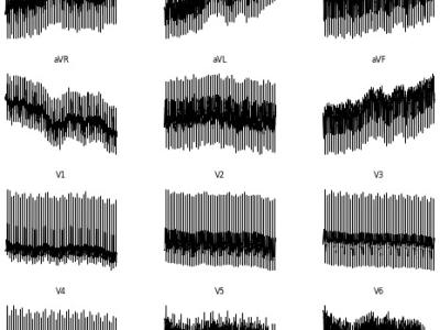
<p>Electrocardiogram (ECG) interpretation is critical for diagnosing a wide range of cardiovascular conditions. To streamline and accelerate the development of deep learning models in this domain, we present a novel, image-based version of the PTB Diagnostic ECG Database tailored for use with convolutional neural networks (CNNs), vision transformers (ViTs), and other image classification architectures. This enhanced dataset consists of 516 grayscale .png images, each representing a 12-lead ECG signal arranged as a 2D matrix (12 × T, where T is the number of time steps).

Abstract

This dataset is utilized for adversarial camouflage generation. We collect vehicle datasets in the CARLA simulation environment under 16 weather conditions. These weather conditions are generated by combining four sun altitude angles (-90°, 10°, 45°, 90°) with four fog densities (0, 25, 50, 90). Within each weather scenario, we randomly choose 16 locations for texture generation. Camera transformation values are randomly selected within specified intervals at each car location.
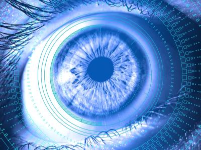
Smart focal-plane and in-chip image processing has emerged as a crucial technology for vision-enabled embedded systems with energy efficiency and privacy. However, the lack of special datasets providing examples of the data that these neuromorphic sensors compute to convey visual information has hindered the adoption of these promising technologies.
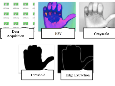
The database presented consists of a set of images of the human hand making signs (20) at various angles, corresponding to the Colombian alphabet of signs established by the National Institute for the Deaf (INSOR). These signs are characterized by being static, that is, they do not require movement to be performed.
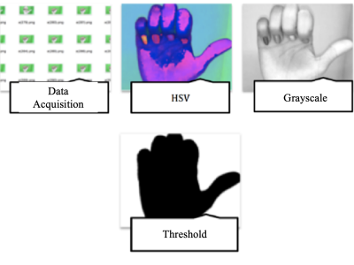
The database presented consists of a set of images of the human hand making signs (20) at various angles, corresponding to the Colombian alphabet of signs established by the National Institute for the Deaf (INSOR). These signs are characterized by being static, that is, they do not require movement to be performed.

As an artificial structure, tailings ponds exhibit regular geometric shapes and relatively straight dams in HRRSIs. Because the typical tailings dam is composed of an initial dam and successive accumulation dams, the tailings dam structure presents obvious linear stripe characteristics. The initial dam, constructed using sand, gravel, or concrete, has a bright color, while the color of the accumulation dam varies based on factors such as particle size, soil coverage, and vegetation restoration.

Egocentric video and Inertial sensor data Kitchen activity dataset is the first V-S-S interaction-focused dataset for the ego-HAR task.
It consists of sequences of everyday kitchen activities involving rich interactions among the subject's body, object, and environment.