ESRI Shapefiles

Six vector maps are selected as experimental data. These maps are referred to as the coastline map, river map, building map, green land map, road map and waterway map, as shown in Fig. 9. The coastline map and river map, both in the China Geodetic Coordinate System 2000 (CGCS2000), can be downloaded from the website of the National Catalogue Service for Geographic Information of China (https://www.webmap.cn).

Categories:
13 Views

the dataset includes geospatial vector point and linestring data, and the data size ranges from 4 million records to 100 million records to evaluate the applicability of HiVQ.

Categories:
4 Views

<p>This is&nbsp;<span style="font-family: Verdana, Arial, Helvetica, sans-serif;">Charlotte street netowrk data.</span></p>

Categories:
194 Views

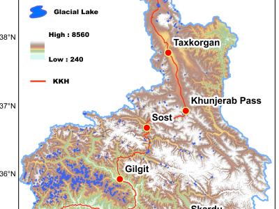
Cloud-free imageries, acquired from Landsat 8 OLI during 2016 to 2018, were used to delineate the extents of the glacial lakes in the mountainous terrain of CPEC

Categories:
366 Views

Emergency  managers  of  today  grapple  with  post-hurricane damage assessment that is often labor-intensive, slow,costly,   and   error-prone.   As   an   important   first   step   towards addressing  the   challenge,   this   paper   presents   the   development of  benchmark  datasets  to  enable  the  automatic  detection  ofdamaged buildings from post-hurricane remote sensing imagerytaken  from  both  airborne  and  satellite  sensors.  Our  work  has two  major  contributions:  (1)  we  propose  a  scalable  framework to  create  benchmark  datasets  of  hurricane-damaged  buildings

Categories:
4556 Views