Artificial Intelligence
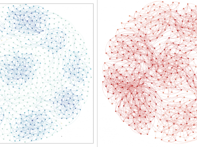
Synthetic data 1: A network contains nine communities. The nodes insides the community are closely connected, and the nodes between communities are sparsely connected.
Synthetic data 2: A network contains nine communities. There are some nodes that connect the nodes in different communities at the same time.
- Categories:
 366 Views
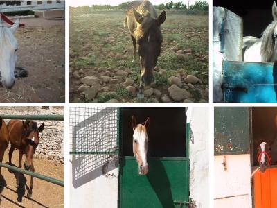
Animal recognition is an active research topic in recent years. Horse’s recognition is an important task in the world and in order to promote horse’s recognition research, the Tunisian Research Groups in Intelligent Machines of University of Sfax (REGIM of Sfax) will provide the Tunisian Horses DataBase of Regim Lab’2015 (THoDBRL’2015) freely of charge to mainly horses’ face recognition researchers and to increase total of researches done to enhance animal recognition. This Database is used in [1].
- Categories:
 981 Views
Animal detection is an active research topic in recent years. Horse’s face detection is an important task in the world and in order to promote horse’s detection and recognition research, the REGIM-Lab.: REsearch Groups in Intelligent Machines, ENIS, University of Sfax, Tunisia will provide the Tunisian Horse Detection Database (THDD) freely of charge to mainly horses’ face detection researchers and to increase total of researches done to enhance animal detection.
- Categories:
 730 Views
Social images analysis from social networks is considered as one of the most popular social technologies. Social images analysis is an active research topic in recent years and in order to promotes social images’s analysis research, the REGIM-Lab.: REsearch Groups in Intelligent Machines, ENIS, University of Sfax, Tunisia provides the SmartCityZen database’2016 freely of charge to social images analysis researchers.
- Categories:
 534 Views
Social images analysis from social networks is considered as one of the most popular social technologies. Social images analysis is an active research topic in recent years and in order to promotes social images’s analysis research, the REGIM-Lab.: REsearch Groups in Intelligent Machines, ENIS, University of Sfax, Tunisia provides the Sm@rtCityZen social images database freely of charge to social images analysis researchers.
- Categories:
 434 Views
Biometric-based hand modality is considered as one of the most popular biometric technologies especially in forensic applications. Hand recognition is an active research topic in recent years and in order to promote hand’s recognition research, the REGIM-Lab.: REsearch Groups in Intelligent Machines, ENIS, University of Sfax, Tunisia provides the REgim Sfax Tunisian hand database (REST database) freely of charge to mainly hand and palmprint recognition researchers.
- Categories:
 2212 Views
Here are some of the software vulnerability real-world data sets.
The original real-world data sets, collected by Lin et al. (https://github.com/DanielLin1986/TransferRepresentationLearning), which contain the source codes of vulnerable and non-vulnerable functions obtained from six real-world software projects, namely FFmpeg, LibTIFF, LibPNG, VLC and Pidgin. These datasets cover both multimedia and image application categories.
- Categories:
 1545 Views
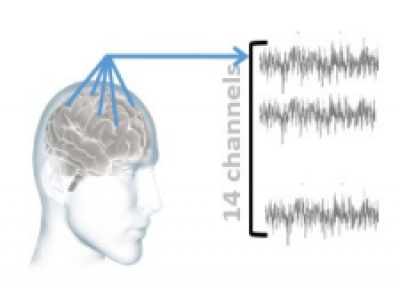
Anxiety affects human capabilities and behavior as much as it affects productivity and quality of life. It can be considered as the main cause of depression and suicide. Anxious states are easily detectable by humans due to their acquired cognition, humans interpret the interlocutor’s tone of speech, gesture, facial expressions and recognize their mental state. There is a need for non-invasive reliable techniques that perform the complex task of anxiety detection.
- Categories:
 10017 Views
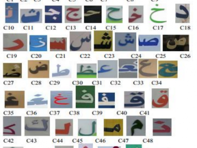
Character recognition has been widely understood as a means of mechanizing the process of understanding text in the written form to facilitate fast and efficient use of text. Indeed, text existing all around us presents information for peoples. However, tourists in foreign countries are unable to understand what indicate text on road signs, shop names, product advertisements, posters, etc. when they are unfamiliar with the native language of the visited country.
- Categories:
 815 Views
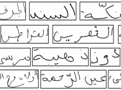
The ADAB database (The Arabic handwriting Data Base) was developed to advance the research and development of Arabic on-line handwritten systems. This database is developed in cooperation between the Institut fuer Nachrichtentechnik (IfN) and Research Groups in Intelligent Machines, University of Sfax, Tunisia. The text written is from 937 Tunisian town/village names. A pre-label assigned to each file consists of the postcode in a sequence of Numeric Character References, which stored in the UPX file format.
- Categories:
 2860 Views