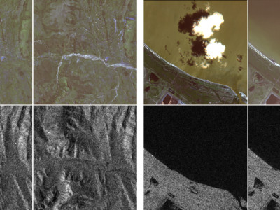
Multispectral

These last decades, Earth Observation brought quantities of new perspectives from geosciences to human activity monitoring. As more data became available, artificial intelligence techniques led to very successful results for understanding remote sensing data. Moreover, various acquisition techniques such as Synthetic Aperture Radar (SAR) can also be used for problems that could not be tackled only through optical images. This is the case for weather-related disasters such as floods or hurricanes, which are generally associated with large clouds cover.

Categories:
12002 Views

The Contest: Goals and Organization


The 2017 IEEE GRSS Data Fusion Contest, organized by the IEEE GRSS Image Analysis and Data Fusion Technical Committee, aimed at promoting progress on fusion and analysis methodologies for multisource remote sensing data.


Categories:
1803 Views

The Data Fusion Contest 2016: Goals and Organization

The 2016 IEEE GRSS Data Fusion Contest, organized by the IEEE GRSS Image Analysis and Data Fusion Technical Committee, aimed at promoting progress on fusion and analysis methodologies for multisource remote sensing data.

New multi-source, multi-temporal data including Very High Resolution (VHR) multi-temporal imagery and video from space were released. First, VHR images (DEIMOS-2 standard products) acquired at two different dates, before and after orthorectification:

Categories:
2084 Views