Climate Change/Environmental
The accurate classification of landfill waste diversion plays a critical role in efficient waste management practices. Traditional approaches, such as visual inspection, weighing and volume measurement, and manual sorting, have been widely used but suffer from subjectivity, scalability, and labour requirements. In contrast, machine learning approaches, particularly Convolutional Neural Networks (CNN), have emerged as powerful deep learning models for waste detection and classification.
- Categories:
 1107 Views
The provided dataset appears to contain weather-related information for New Delhi Safdarjung, India, spanning from January 1, 2023, to July 21, 2023. The dataset includes the following columns: Station ID, Station Name, Date, Precipitation (PRCP), Average Temperature (TAVG), Maximum Temperature (TMThe dataset includes daily observations with information on precipitation and temperature. It seems that some values are missing (NULL values), and there are variations in the units used for precipitation AX), and Minimum Temperature (TMIN).
- Categories:
 3481 Views
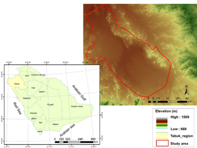
In this short communication we present the results taken from the real-time weather dataset of Tabouk City, Saudi Arabia. In the results we have applied machine learning techniques to predict the future air temperature of the region. This dataset's results have informed in the creation of determinants driving agricultural and urban expansion contribute to the analysis of the main causes of land use change.
- Categories:
 87 Views
In this short communication we present the results taken from the real-time weather dataset of Tabouk City, Saudi Arabia. In the results we have applied machine learning techniques to predict the future air temperature of the region. This dataset's results have informed in the creation of determinants driving agricultural and urban expansion contribute to the analysis of the main causes of land use change.
- Categories:
 25 Views
Climate change has been a worldwide concern for more than 50 years now and climate change misinformation has also been a critical issue as it questions the causes and effects of climate change, hence disturbing climate action. Climate misinformation has been a major obstacle to mitigating climate change and its effects, and it even aggravated the issue and polarized the public. In this paper, we introduce a new climate change misinformation and stance detection dataset namely ClimateMiSt, consisting of both social media data and news article data with manually verified labels.
- Categories:
 1340 Views
ERA5 derived time series of European country-aggregate electricity demand, wind power generation and solar power generation: hourly data from 1979-2019. The ERA5 reanalysis data (1979-2019) has been used to calculate the hourly country aggregated wind and solar power generation for 28 European countries based on a distribution of wind and solar farms which is considered to be representative of the 2017 situation. In addition a corresponding daily time series of nationally aggregated electricity demand is provided.
- Categories:
 683 Views
The temporal variability in calving front positions of marine-terminating glaciers permits inference on the frontal ablation. Frontal ablation, the sum of the calving rate and the melt rate at the terminus, significantly contributes to the mass balance of glaciers. Therefore, the glacier area has been declared as an Essential Climate Variable product by the World Meteorological Organization. The presented dataset provides the necessary information for training deep learning techniques to automate the process of calving front delineation.
- Categories:
 228 Views
In the wake of marine oil exploration and transportation, the accidents of oil spills have occurred
frequently around the world, which leads to the severe pollution of the marine environment and the
huge damage of coastal species [1–6]. On April 20, 2010, the explosion of Deepwater Horizon oil
drilling platform led to a severe leakage. Million barrels of oil polluted the Gulf of Mexico with the
area of about 10,000 square kilometers [7, 8]. Due to this accident, the marine ecosystems, such as fish
- Categories:
 905 Views
urrently, a significant amount of research is focused on detecting Marine Debris and assessing its spectral behaviour via remote sensing, ultimately aiming at new operational monitoring solutions. Here, we introduce a Marine Debris Archive (MARIDA), as a benchmark dataset for developing and evaluating Machine Learning (ML) algorithms capable of detecting Marine Debris.
- Categories:
 519 Views
This dataset consists of 3500 images of beach litter and 3500 corresponding pixel-wise labelled images. Although performing such pixel-by-pixel semantic masking is expensive, it allows us to build machine-learning models that can perform more sophisticated automated visual processing. We believe this dataset may be of significance to the scientific communities concerned with marine pollution and computer vision, as this dataset can be used for benchmarking in the tasks involving the evaluation of marine pollution with various machine learning models.
- Categories:
 534 Views


