Image Processing
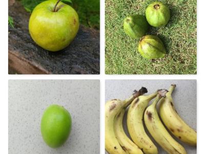
INDIA is the second-largest fruit and vegetable exporter in the world after China. It ranked first in the production of Bananas, Papayas, and Mangoes. Public datasets of fruits are available but they are limited to general fruit classes and failed to classify the fruits according to the fruit quality. To overcome this problem, we have created a dataset named FruitsGB (Fruits Good/Bad) dataset.
- Categories:
 6723 Views
We establish a new large-scale benchmark that contains 30 ground-truth images and 900 synthetic underwater images of the same scene, called synthetic underwater image dataset (SUID). The proposed SUID creates possibility for a full-reference evaluation of existing technologies for underwater image enhancement and restoration.
- Categories:
10187 Views
The dataset comprises of image file s of size 20 x 20 pixels for various types of metals and non-metal.The data collected has been augmented, scaled and modified to represent a number a training set dataset.It can be used to detect and identify object type based on material type in the image.In this process both training data set and test data set can be generated from these image files.
- Categories:
2143 Views
Reconsructed images (video sequences) and results for the paper: "Adaptive block compressive sensing for distributed video coding"
- Categories:
137 Views
This dataset was created from all Landsat-8 images from South America in the year 2018. More than 31 thousand images were processed (15 TB of data), and approximately on half of them active fire pixels were found. The Landsat-8 sensor has 30 meters of spatial resolution (1 panchromatic band of 15m), 16 bits of radiometric resolution and 16 days of temporal resolution (revisit). The images in our dataset are in TIFF (geotiff) format with 10 bands (excluding the 15m panchromatic band).
- Categories:
6864 Views
These File is group by 7 different datasets with the task of salient object detect.Each folder is an open data set of SOD, which is composed of multiple JPG files. Each JPG picture corresponds to a annotation picture which exists in PNG format.
- Categories:
520 Views
Level 2 data set. Averaging over multiple measurements were performed to reduce electronic noise and jitter
- Categories:
95 Views
The dataset contains rash images of 11 different disease states. Images of normal skin are also included in the dataset.
- Categories:
18712 Views
This dataset is accompanying the manuscript "Lossless archiving view arrays from plenoptic cameras when camera sensor images are available" by Ioan Tabus and Emanuele Palma, published in ISSCS 2021 in July 2021. It is also supporting part of the work carried out in “Lossless Compression of Plenoptic Camera Sensor Images” by Ioan Tabus and Emanuele Palma, published in IEEE Access in February 2021. It contains the archives and the programs for reconstructing the light field datasets publicly used in two major challenges for light field compression.
- Categories:
280 Views
This dataset extends the Urban Semantic 3D (US3D) dataset developed and first released for the 2019 IEEE GRSS Data Fusion Contest (DFC19). We provide additional geographic tiles to supplement the DFC19 training data and also new data for each tile to enable training and validation of models to predict geocentric pose, defined as an object's height above ground and orientation with respect to gravity. We also add to the DFC19 data from Jacksonville, Florida and Omaha, Nebraska with new geographic tiles from Atlanta, Georgia.
- Categories:
11256 Views