Envi image format
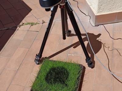
Hyperspectral imaging (HSI) has become a pivotal tool for environmental monitoring, particularly in identifying and analyzing hydrocarbon spills. This study presents an Internet of Things (IoT)-based framework for the collection, management, and analysis of hyperspectral data, employing a controlled experimental setup to simulate hydrocarbon contamination. Using a state-of-the-art hyperspectral camera, a dataset of 116 images was generated, encompassing temporal and spectral variations of gasoline, thinner, and motor oil spills.
- Categories:
 289 Views
This dataset in conformed by hyperspectral images captured with the Fx10 camera. The images show the dissolutions of different concentrations of rhodamine. The Rhodamine Water Tracer, hereafter referred to as rhodamine, is a fluorescent dye primarily used as a tracer in aquatic environments. The rhodamine was purchased from ThermoFisher Scientific, identified by the chemical codes CAS 37299-86-8 and 7732-18-5, with catalogue number 446971000.
- Categories:
 31 Views
The Kansas AHSI dataset was collected by the visible-SWIR AHSI designed by the Shanghai Institute of Technical Physics, Chinese Academy of Sciences, which was one of the main payloads onboard the GF-5 satellite. The Kansas AHSI dataset covers 330 spectral bands to characterize the solar reflective regime from 400 to 2500 nm. The spectral resolution is about 5 nm for the visible and near infrared (VNIR) region from 400 to 1000 nm, and 10 nm for the visible-shortwave infrared (SWIR) region from 1000 to 2500 nm. The spatial resolution is around 30 m.
- Categories:
 391 Views
The SPYSTUF hyperspectral data contains high spatial and spectral resolution Aisa Eagle II (visible to near infrared, 400-900 nm) airborne imaging spectrometer above a Hyytiälä forest research station hosting the SMEAR II (Station for Measuring Ecosystem-Atmosphere Relations, 61°50' N, 24°17' E) on 3 July 2015. The spectral resolution of the data is 4.6 nm, and the spatial resolution 0.6 m.
- Categories:
 1153 Views

