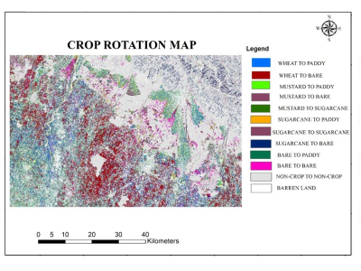
Multi-temporal
Accurate information about crop rotation is essential for administrators, managers and various government departments for assessment, monitoring, and management of various resources for crop escalation. Radar remote sensing, because of its all-weather capability and assured uninterrupted data supply can show a substantial part in the evaluation of crop rotation.
- Categories:

The Data Fusion Contest 2016: Goals and Organization
The 2016 IEEE GRSS Data Fusion Contest, organized by the IEEE GRSS Image Analysis and Data Fusion Technical Committee, aimed at promoting progress on fusion and analysis methodologies for multisource remote sensing data.
New multi-source, multi-temporal data including Very High Resolution (VHR) multi-temporal imagery and video from space were released. First, VHR images (DEIMOS-2 standard products) acquired at two different dates, before and after orthorectification:
- Categories: