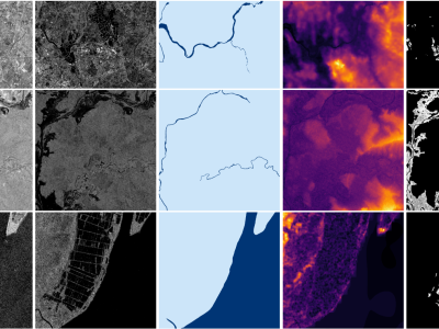
This dataset contains image masks from KiTTy obtained by running SAM. In the future, it is planned to add other masks from OpenSEED, SEEM, SAM (new version).
The study is carried out in order to study segmentation on point clouds
This dataset contains image masks from KiTTy obtained by running SAM. In the future, it is planned to add other masks from OpenSEED, SEEM, SAM (new version).
The study is carried out in order to study segmentation on point clouds
- Categories: