Wireless Networking

The dataset includes the coordinates of a 2980 antenna array.
- Categories:
 16 Views
In this dataset, we conducted a spectrum monitoring experiment in an urban environment. The helikite flies up to an altitude of 400 feet throughout the day from noon to 9 p.m. during NC State’s Packapalooza festival in August, 2022. The spectrum is swept up to 6 GHz. Every sweep takes around 1 minute, while after every 4 measurements, the 5th measurement takes close to 5 minutes due to another data collection activity running in parallel. The photo of a flying Helikite at the experiment site is shown in the dataset image.
- Categories:
 343 Views
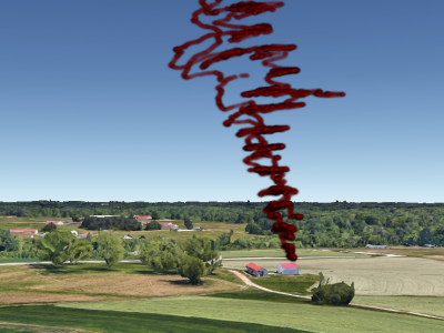
In this dataset, we conduct the spectrum monitoring experiment in AERPAW Lake Wheeler site, which can be classified as a rural area. The helikite flies up to an altitude of 500 feet at increments of 10 meters, while waiting for 5 minutes in between altitude changes. The spectrum is monitored up to 6~GHz. The trajectory of the helikite mapped on top of the experiment site during the flight is in the dataset image. Small random variations in altitude due to wind can also be observed.
- Categories:
 164 Views
ImgFi converts wifi channel state information into images, improving feature extraction and achieving 99.5% accuracy in human activity recognition using only three layers of convolution. In addition to the self-test dataset, three publicly available high-quality datasets, WiAR, SAR and Widar3.0, are used. WiAR collects 16 activity-reflected WiFi signals; SAR collects WiFi signals in response to 6 actions performed by 9 volunteers over 6 days, while Widar3.0 collects 6 action signals from 5 volunteers at different locations and antenna orientations.
- Categories:
 1790 Views
AirForce Security Dataset (AFSD) that offers many advantages over the AWID dataset for detecting Evil Twin attacks. The AFSD dataset was created through a carefully planned and executed simulation of an Evil Twin attack considering the characteristics of both the attacks and the WiFi environment.
- Categories:
 420 Views
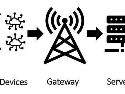
IoT has a significant role in smart campus. LoRaWAN is an emerging technology that enables serving hundreds of IoT devices. In this dataset, we present a the data results from the LoRa communication model between the devices and the gateway and between the gateway and the processing server. In addition, we present the physical readings sensed by the LoRa devices. This dataset is very rich and can be used in many applications, such as time-series forecasting, number of people prediction, and veryfing spatial correlation algorithms.
- Categories:
 855 Views
This dataset contains CIRs from 23 different positions in an industrial environment, as illustrated in the picture.
These originate from a tag-anchor pair configured with two-way-ranging for distance estimations. In total, 21 anchors are placed in the area, allowing both Line-of-Sight (LOS) and Non-LOS (NLOS) signal propagation, as illustrated in the picture.
The aim during the data collection proces was to measure UWB ranging errors in (N)LOS environments. As such, the ground truth of each position was measured using a laser.
- Categories:
 662 Views
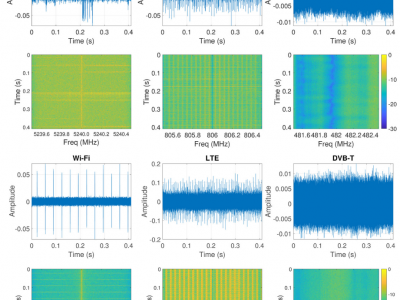
This dataset contains IQ samples captured over-the-air in six different locations in Gent, Belgium (UZ, Reep, Rabot, Merelbeke, iGent and Gentbrugge). Each location has unique data characteristics (e.g. different signal strength and noise levels) due to different physical signal propagations. As an example, these differences in two locations (top two and bottom two rows) are displayed on the spectrograms.
- Categories:
 991 Views


