Spectrum Measurements by a Helikite in an Urban Area

- Citation Author(s):
-
Sung Joon Maeng (North Carolina State University)Ozgur Ozdemir (North Carolina State University)Ismail Guvenc (North Carolina State University)Mihail Sichitiu (North Carolina State University)
- Submitted by:
- Sung Joon Maeng
- Last updated:
- DOI:
- 10.21227/p480-qp62
- Data Format:
- Research Article Link:
 363 views
- Categories:
- Keywords:
Abstract
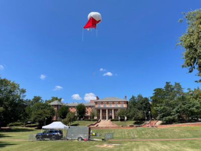
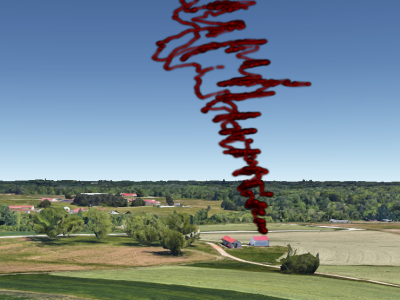
In this dataset, we conducted a spectrum monitoring experiment in an urban environment. The helikite flies up to an altitude of 400 feet throughout the day from noon to 9 p.m. during NC State’s Packapalooza festival in August, 2022. The spectrum is swept up to 6 GHz. Every sweep takes around 1 minute, while after every 4 measurements, the 5th measurement takes close to 5 minutes due to another data collection activity running in parallel. The photo of a flying Helikite at the experiment site is shown in the dataset image. The helikite goes up and stays at an altitude of around 400 feet and goes down around an altitude of around 70 feet four times during the whole measurement period.
Instructions:
Spectrum monitoring dataset by a helikite in an urban area, which is measured by AERPAW.
The dataset is formatted by SigMF. Please find instructions in the attached readmefile.
MATLAB post-processing code for the dataset is attached as well.


thanks.