Datasets
Standard Dataset
Multimodal Remote Sensing Dataset for Landslide Change Detection in Haiti
- Citation Author(s):
-
BRALETAntoine
 USMB - LISTICTROUVÉEmmanuelUSMB - LISTICCHANUSSOTJocelynUniv. Grenoble Alpes, Inria, CNRS, Grenoble INP, LJKATTOAbdourrahmane M.USMB - LISTIC
 - Submitted by:
- Antoine Bralet
- Last updated:
- Sun, 07/14/2024 - 08:22
- DOI:
- 10.21227/4heb-7h07
- Data Format:
- License:
 1011 Views
- Categories:
- Keywords:
Abstract
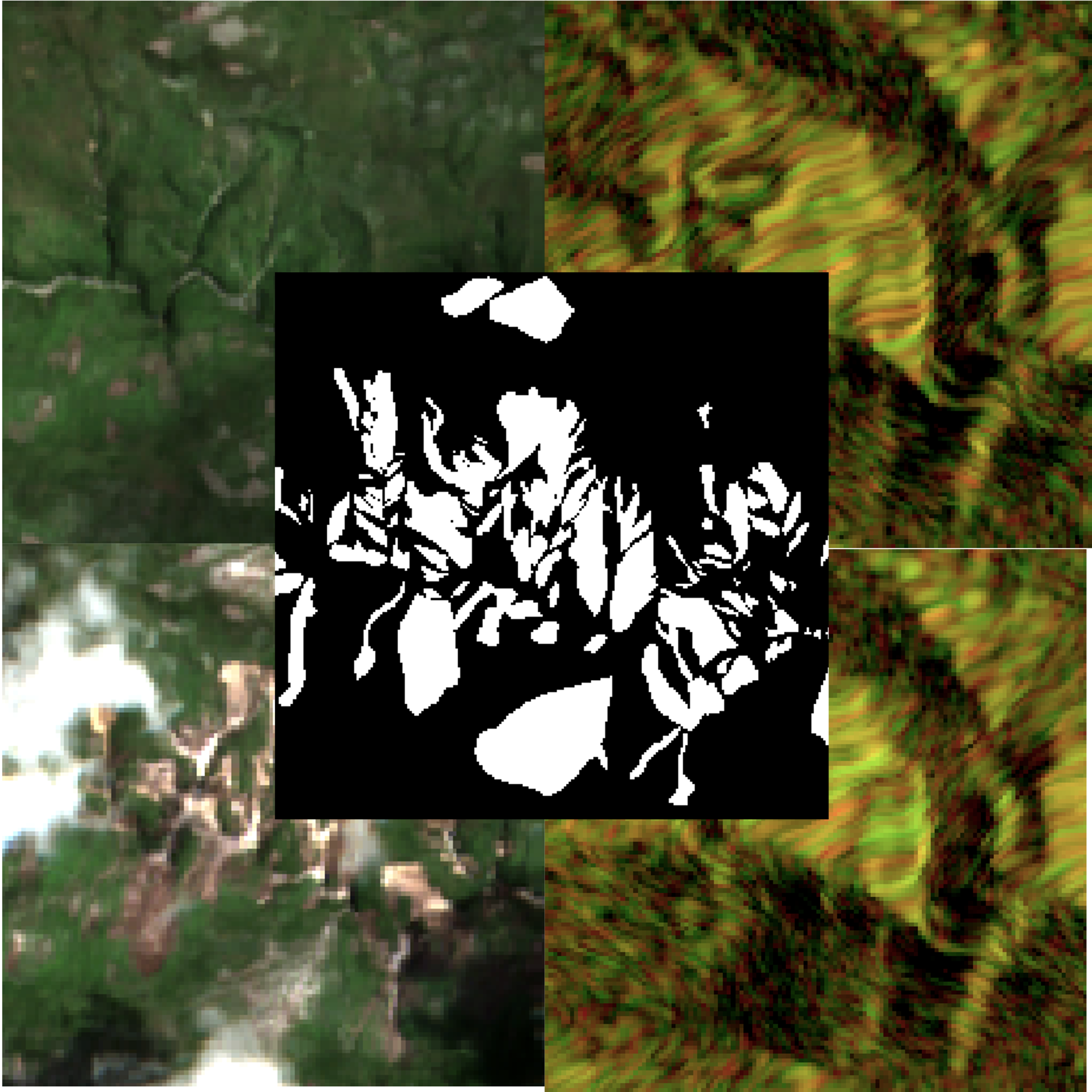
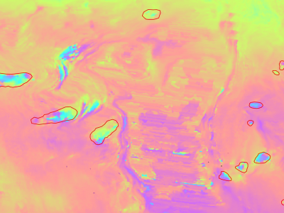
The detection of the collapse of landslides trigerred by intense natural hazards, such as earthquakes and rainfall, allows rapid response to hazards which turned into disasters. The use of remote sensing imagery is mostly considered to cover wide areas and assess even more rapidly the threats. Yet, since optical images are sensitive to cloud coverage, their use is limited in case of emergency response. The proposed dataset is thus multimodal and targets the early detection of landslides following the disastrous earthquake which occurred in Haiti in 2021. It consists of SAR-optical pairs from Sentinel-1 and Sentinel-2 acquired shortly before and after the event. To encourage for machine and deep learning algorithms, the images are cropped into 1713 patches. Since Sentinel-1 SAR images are acquired both in ascending and descending passes, twice more patches are available in this modality. Due to the mountainous nature of the terrain, the images are provided together with a layover-shadow mask computed as described in [Meier et al, 1993]. This mask is destined to limit the impact of geometrical distortions on the algorithm. Similarly, Sentinel-2 optical images are provided with a cloud and cloud shadow mask. Landslide annotations are extracted from the TODO database from NASA, rasterized and croped similarly to the images. The dataset is aimed to be used whether for monomodal or multimodal approaches, and whether for monotemporal or bitemporal approaches.
[Meier et al., 1993] Meier, E., Frei, U., and Nüesch, D. (1993). Precise Terrain Corrected Geocoded Images. SAR Geocoding: Data and Systems, pages 173–185. Publisher: Karlsruhe, Germany: Herbert Wichmann Verlag GmbH.
Pre and post images are given in separate folders, each folder contains the SAR image in ascending and descending pases (separate subfolders) and the optical images.
The name of the images and of the annotations are identical for fast identification.

Dataset Files
- Pre_event.tar.gz (580.86 MB)
- Post_event.tar.gz (588.08 MB)
- Annotations.tar.gz (1.31 MB)


Comments
SSS
Thank alot for the dataset.