Magnetic Field Mapping of a Landmine Field Using a Magnetometer-integrated Drone and Intelligent Application
- Citation Author(s):
- Submitted by:
- Kaya Kuru
- Last updated:
- DOI:
- 10.21227/ebny-b828
- Data Format:
Abstract
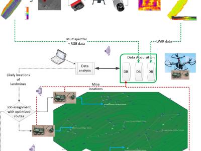
In this research, a small-scale drone with the required magnetometer sensor technologies and novel intelligent automated techniques -- Maggy, was built to automate and ease the procedures of cleaning landmines and UXO/IDE. The dataset with an MP4-formated video demonstrates how a magnetometer-integrated autonomous drone can map the magnetic field of a landmine region effectively and efficiently using an intelligent application through near real-time data streaming.
Instructions:
The dataset with an MP4-formated video demonstrates how a magnetometer-integrated autonomous drone can map the magnetic field of a landmine region effectively and efficiently using an intelligent application through near real-time data streaming.
 233 views







Hi,
I'm working on Landmine Detection as my Master's thesis. Can I access your Dataset for my Research Please?