Landsat_combined_npz_files

- Citation Author(s):
- Submitted by:
- Aatmaj Salunke
- Last updated:
- DOI:
- 10.21227/rdfm-md81
- Data Format:
 31 views
- Categories:
- Keywords:
Abstract
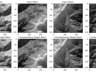
The Landsat 8 imagery, sourced from USGS Earth Explorer, covers diverse regions like the northeastern USA snow region, Brazilian forests, UAE deserts, and Indian zones (northern, central, and southern) from 2018 to 2023, capturing long-term trends and seasonal changes. The dataset, including bands B4, B5, and B10 with 30-meter resolution from LANDSAT/LC08/C02/T1\_TOA imagery, is crucial for accurate LST and emissivity prediction models. These bands capture vital land surface properties like vegetation health, moisture, and thermal characteristics, enhancing model reliability. Also it containes the key target image bands, derived from LANDSAT/LC08/C02/T1\_L2 data: ST\_B10 (Band 10 surface temperature) and ST\_EMIS (Emissivity of Band 10). These images are crucial for analyzing thermal behavior, emissivity, and surface energy balance, offering insights into environmental processes.
Instructions:
The Landsat 8 dataset sourced from USGS Earth Explorer provides imagery covering various regions globally from 2018 to 2023, including the northeastern USA snow region, Brazilian forests, UAE deserts, and Indian zones (northern, central, and southern). The dataset consists of bands B4, B5, and B10 with a 30-meter resolution from LANDSAT/LC08/C02/T1_TOA imagery, crucial for accurate prediction models of Land Surface Temperature (LST) and emissivity. These bands capture essential land surface properties such as vegetation health, moisture, and thermal characteristics, which significantly enhance the reliability of predictive models. Additionally, the dataset contains target image bands derived from LANDSAT/LC08/C02/T1_L2 data: ST_B10 (Band 10 surface temperature) and ST_EMIS (Emissivity of Band 10). These images are indispensable for analyzing thermal behavior, emissivity, and surface energy balance, providing valuable insights into environmental processes. The dataset is preprocessed and compressed into a .npz file format, with input images stored in arr_0 and target images in arr_1. Users can utilize this dataset for various applications, including but not limited to climate modeling, environmental monitoring, and land use planning.


