brightness temperature

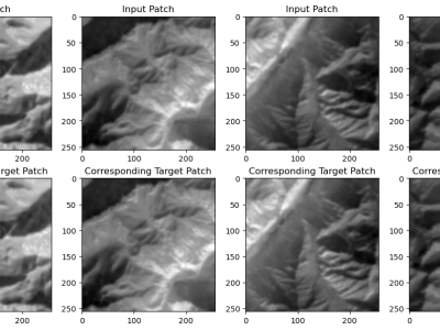
The Landsat 8 imagery, sourced from USGS Earth Explorer, covers diverse regions like the northeastern USA snow region, Brazilian forests, UAE deserts, and Indian zones (northern, central, and southern) from 2018 to 2023, capturing long-term trends and seasonal changes. The dataset, including bands B4, B5, and B10 with 30-meter resolution from LANDSAT/LC08/C02/T1\_TOA imagery, is crucial for accurate LST and emissivity prediction models. These bands capture vital land surface properties like vegetation health, moisture, and thermal characteristics, enhancing model reliability.

Categories:
17 Views

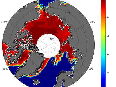
Sea ice concentration is important because it helps in determining important climate variables. Together with sea ice thickness, important fluxes between air and sea as well as heat transfer between the atmosphere can be determined. We designed an adapted bootstrap algorithm called SARAL/AltiKa Sea Ice Algorithm (SSIA) with some tunings and segregated the algorithm into winter and summer algorithms to estimate daily sea ice concentration (SIC) in the Arctic.

Categories:
183 Views

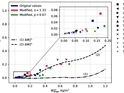
A computational experiment has been performed in order to evaluate systematic errors of atmospheric Total Water Vapor (TWV) and integral Liquid Water Content (LWC) microwave radiometric retrieval from satellites by means of dual-frequency method (inverse problem).  The errors under consideration may arise due to the non-linearity of brightness temperature level on true liquid water and effective cloud temperature dependencies and due to neglecting the spatial distribution of cumulus clouds in the satellite microwave radiometer antenna field-of-view (FOV).

Categories:
194 Views

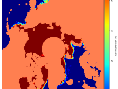
The concentration of sea ice is essential for determining crucial climate factors. Together with sea ice thickness, it is possible to determine significant air-sea fluxes and atmospheric heat transfer. In this study, the SARAL/AltiKa Sea Ice Algorithm is used to determine the monthly sea ice concentration (SIC) in the Arctic (SSIA). For the period from April 2013 to December 2020, data from the dual-frequency microwave radiometer (23.8 GHz and 37 GHz) on the SARAL/AltiKa satellite are used to compute SIC. 

Categories:
147 Views