Datasets
Standard Dataset
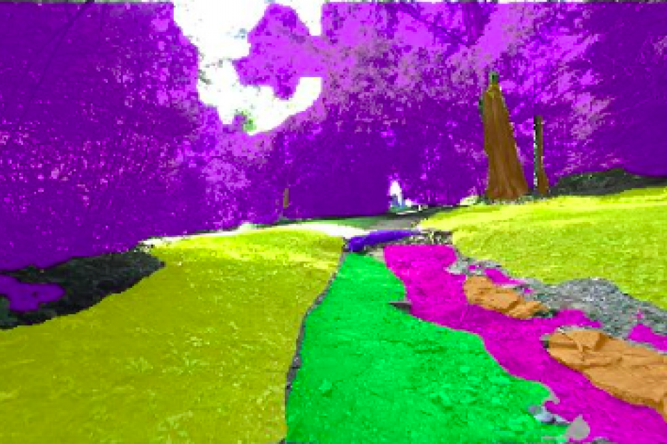
Hiking Trail Semantic Segmentation Image Dataset
- Citation Author(s):
- Submitted by:
- Camndon Reed
- Last updated:
- Sun, 09/15/2024 - 16:58
- DOI:
- 10.21227/jpr2-r806
- License:
 607 Views
- Categories:
- Keywords:
Abstract
This work presents a specialized dataset designed to advance autonomous navigation in hiking trail and off-road natural environments. The dataset comprises over 1,250 images (640x360 pixels) captured using a camera mounted on a tele-operated robot on hiking trails. Images are manually labeled into eight terrain classes: grass, rock, trail, root, structure, tree trunk, vegetation, and rough trail. The dataset is provided in its original form without augmentations or resizing, allowing end-users flexibility in preprocessing. A pre-trained YOLO model is included, achieving 75.8% mean average precision across all classes and 96.7% for established trail identification. During training, this model utilized data augmentation techniques including rotations (+/- 13deg), shear (4deg in all directions), and random noise (up to 0.18% of pixels). The dataset is split into training (70%), validation (20%), and test (10%) sets. This resource is particularly valuable for researchers developing autonomous navigation systems for trail maintenance robots and outdoor mobile platforms. It also supports applications in trail condition monitoring and ecosystem assessment, enabling advancements in trail management and conservation efforts in natural recreational areas.
Usage Instructions
1. Dataset Contents
This dataset contains images of hiking trails with corresponding annotations in two formats:
- Coco segmentation masks
- YOLOv8-oriented bounding boxes
The dataset is split into training, validation, and test sets.
2. Image Format
- Resolution: 640x360 pixels
- Pre-processing steps: none
3. Annotation Formats
a. COCO segmentation
- provides pixel-level annotations for each terrain class
- Format: JSON files following COCO dataset structures
- Each segmentation mask corresponds to an image file
b. YOLOv8-oriented Bounding Boxes
- Provides oriented bounding box annotations for each terrain class
- Format: Text files in YOLOv8 format
- Each text file corresponds to an image file
The dataset can also be found in the RoboFlow Universe here: https://universe.roboflow.com/reu-rover-project/arboretum-less-classes, where you may download it in any format you may need.
4. Classes
The dataset includes 8 terrain classes:
- Grass
- Rock
- Trail
- Root
- Structure
- Tree trunk
- Vegetation
- Rough trail
5. Using the Annotations
- For COCO segmentation, use standard COCO API or custom scripts to load and process the annotations.
- For YOLOv8 bounding boxes, refer to the YOLOv8 documentation for loading and using the annotations: https://github.com/ultralytics/ultralytics
6. Pre-trained Model
A pre-trained YOLOv8 model is included with the dataset. To use it please refer to the official YOLOv8 documentation: https://github.com/ultralytics/ultralytics


