Datasets
Standard Dataset
Multispectral Dataset for parts of the coastal area of Gwadar, Pakistan
- Citation Author(s):
- Submitted by:
- Jiaqiyu Zhan
- Last updated:
- Tue, 03/19/2024 - 03:41
- DOI:
- 10.21227/mh6q-6008
- Data Format:
- License:
 311 Views
- Categories:
- Keywords:
Abstract
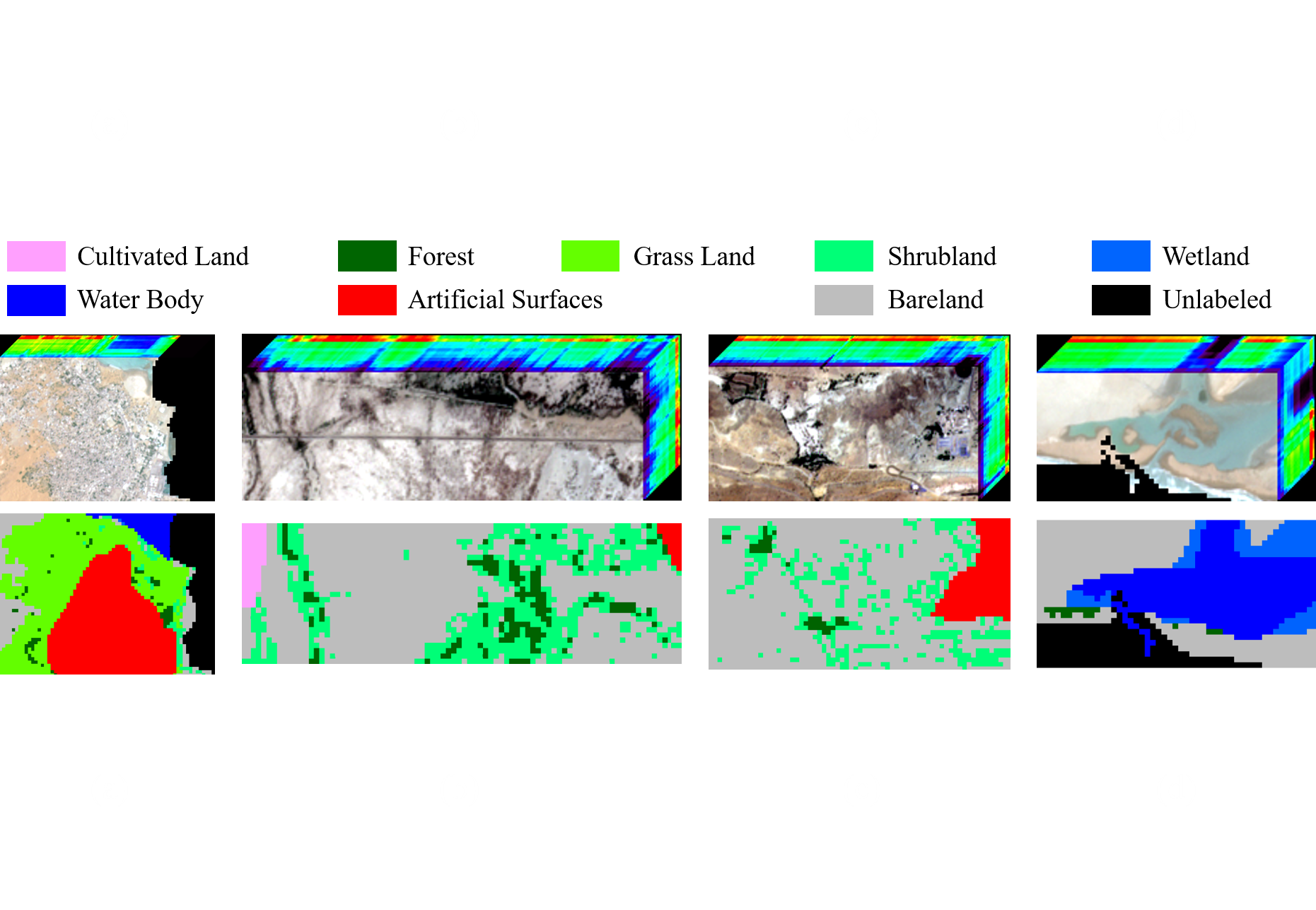
To test the feasibility of the idea: Using the processed data of sentinel-2 and GlobeLand30 as the input image and ground truth of subspace clustering for land cover classification, a dataset named 'MSI_Gwadar' is created.
'MSI_Gwadar' is a multi-spectral remote sensing image of Gwadar (town and seaport, southwestern Pakistan) and its four regions of interest, which includes MATLAB data files and ground truth files of the study area and its four regions of interest.
landcover & value(类型及赋值):
1 - Cultivated Land/耕地
2 - Forest/林地
3 - Grass Land/草地
4 - Shrubland/灌木地
5 - Wetland/湿地
6 - Water Body/水体
7 - Bareland/裸地
8 - Permanent Snow and Ice/冰川和永久积雪
(0 - Unlabeled Pixel/无效像元)
[ All Data ]
Files: Gwadar_data_lc8.mat & Gwadar_gt_lc8.mat
Size: 2472*15027
Labeled Pixel: 14873094
Number of Class: 8
[ ROI 1 ]
Files: Gwadar_roi1_data.mat & Gwadar_roi1_gt.mat
Size: 150*200
Labeled Pixel: 25821
Number of Class: 7
[ ROI 2 ]
Files: Gwadar_roi2_data.mat & Gwadar_roi2_gt.mat
Size: 80*250
Labeled Pixel: 20000
Number of Class: 5
[ ROI 3 ]
Files: Gwadar_roi3_data.mat & Gwadar_roi3_gt.mat
Size: 100*200
Labeled Pixel: 20000
Number of Class: 5
[ ROI 4 ]
Files: Gwadar_roi4_data.mat & Gwadar_roi4_gt.mat
Size: 80*150
Labeled Pixel: 12000
Number of Class: 4


Comments
Need dataset