Indian Regions Soil Image Database (IRSID): A dataset for classification of Indian soils
- Citation Author(s):
-
D N Kiran Pandiri
 (National Institute of Technology Silchar)
R Murugan
(National Institute of Technology Silchar)
Tripti Goel
(National Institute of Technology Silchar)
(National Institute of Technology Silchar)
R Murugan
(National Institute of Technology Silchar)
Tripti Goel
(National Institute of Technology Silchar)
- Submitted by:
- R MURUGAN
- Last updated:
- DOI:
- 10.21227/2zz3-f173
- Data Format:
 12343 views
Abstract
Indian Regions Soil Image Database (IRSID) : A dataset for classification of Indian soil types
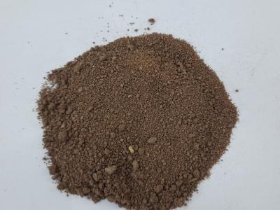
The database “Indian Regions Soil Image Database (IRSID)”, represent the Indian soil types. The dataset provides information on the soil for each image. This helps in the development and evaluation of an image analysis algorithm for the classification of soil type. The dataset consists of original color images of the sand, clay, sandy loam, loam, and loam sandy soil types. The images of the soil samples are collected from two different regions in Andhra Pradesh state, India. As the samples collected region is situated near the Godavari basin, most of the soil samples collected are either sand or clay. The samples that are collected in Madanapalle, Andhra Pradesh, India are sandy loam and loam soils. The total number of soil samples collected is 16 numbers. The soil images are captured by using an android mobile camera with 48 megapixels ISOCELL GM2 sensor with an f/2.0 aperture lens. The ISOCELL imager providesa broader, clearer viewing experience to mobile device users. Smart Wide Dynamic Range (WDR) technology of ISOCELL can capture the details more accurately in both bright and dark areas, even in high contrast lighting conditions. The collected test samples were tested in the soil mechanics lab by using sieve analysis and hydrometer test to find out the percentage of sand, silt, and clay in each soil sample. By plotting these percentage values on the USDA soil texture triangle, soil texture type can be identified. The test data of each sample is provided in .csv file.
Instructions:
NA


In reply to i wanted to use it for my by avinash nair
In reply to i wanted to use it for my by avinash nair
In reply to Use it for research purpose by Prasanth Duba
In reply to i want for research purpose by chhaya narvekar
I want to access this datasets for research purpose
Respected sir/madam
I am a phd scholar and i need your datasets for my research project please allow me to access your dataset.