Sentinel-1; SAR; deep learning; land cover mapping; classification; semantic segmentation
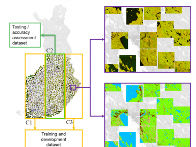
Here, a dataset used in manuscript "Wide-Area Land Cover Mapping with Sentinel-1 Imagery using Deep Learning Semantic Segmentation Models" Scepanovic et al. (https://doi.org/10.1109/JSTARS.2021.3116094) is published. The data contains preprocessed SAR backscatter digital numbers as 7000 geotiff image patches of size 512x512 (about 10 km x 10 km size) sampled from several wide-area SAR mosaics compiled from all summer Sentinel-1A images acquired over Finland in the summer of 2018.
- Categories:
 669 Views