Datasets
Open Access
Vehicular Mobility Trace at Seoul, South Korea

- Citation Author(s):
- Submitted by:
- Dr. Farooque Kumbhar
- Last updated:
- Tue, 05/17/2022 - 22:21
- DOI:
- 10.21227/kjzd-rk05
- Data Format:
- Link to Paper:
- License:
 1243 Views
- Categories:
- Keywords:
Abstract
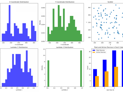
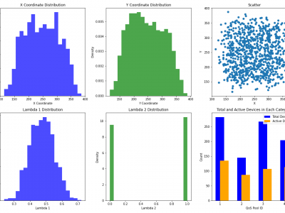
The trace location in Seoul, South Korea has an area spanning over 2.5 × 1.5 km where there are are more than 30 intersections. A number of simulated vehicles are moving in the road topology. Each vehicle shows following properties for every second:
timestep(simulation) secondsThe time step described by the values within this timestep-element
ididThe id of the vehicle
typeidThe name of the vehicle type
speedm/sThe speed of the vehicle
angledegreeThe angle of the vehicle in navigational standard (0-360 degrees, going clockwise with 0 at the 12'o clock position)
xm or longitudeThe absolute X coordinate of the vehicle (center of front bumper). The value depends on the given geographic projection
ym or latitudeThe absolute Y coordinate of the vehicle (center of front bumper). The value depends on the given geographic projection
zmThe z value of the vehicle (center of front bumper).
Note: This value is only present if the network contains elevation data
posm.The running position of the vehicle measured from the start of the current lane.
laneidThe id of the current lane.
slopedegreeThe slope of the vehicle in degrees (equals the slope of the road at the current position)
signalsbitsetThe signal state information (blinkers, etc). Only present when option --fcd-output.signals is set.
XML Format is:
<fcd-export>
<timestep time="<TIME_STEP>">
<vehicle id="<VEHICLE_ID>" x="<VEHICLE_POS_X>" y="<VEHICLE_POS_Y>" angle="<VEHICLE_ANGLE>" type="<VEHICLE_TYPE>"
speed="<VEHICLE_SPEED>"/>
... more vehicles ...
</timestep>
... next timestep ...
</fcd-export>
The trace location in Seoul, South Korea has an area spanning over 2.5 × 1.5 km where there are are more than 30 intersections. A number of simulated vehicles are moving in the road topology. Each vehicle shows following properties for every second:
timestep(simulation) secondsThe time step described by the values within this timestep-element
ididThe id of the vehicle
typeidThe name of the vehicle type
speedm/sThe speed of the vehicle
angledegreeThe angle of the vehicle in navigational standard (0-360 degrees, going clockwise with 0 at the 12'o clock position)
xm or longitudeThe absolute X coordinate of the vehicle (center of front bumper). The value depends on the given geographic projection
ym or latitudeThe absolute Y coordinate of the vehicle (center of front bumper). The value depends on the given geographic projection
zmThe z value of the vehicle (center of front bumper).
Note: This value is only present if the network contains elevation data
posmThe running position of the vehicle measured from the start of the current lane.
laneidThe id of the current lane.
slopedegreeThe slope of the vehicle in degrees (equals the slope of the road at the current position)
signalsbitsetThe signal state information (blinkers, etc). Only present when option --fcd-output.signals is set.
Dataset Files
This file contains two traces for sparse and dense traffic scenarios. OpenStreetMap 2 Traces.zip (197.57 MB)
Open Access dataset files are accessible to all logged in users. Don't have a login? Create a free IEEE account. IEEE Membership is not required.


