Datasets
Standard Dataset
Arctic sea ice concentration from SARAL/AltiKa radiometer Version 2
- Citation Author(s):
- Submitted by:
- Thombson Chungkham
- Last updated:
- Tue, 04/02/2024 - 01:51
- DOI:
- 10.21227/xets-5k38
- Data Format:
- Research Article Link:
- License:
 212 Views
- Categories:
- Keywords:
Abstract
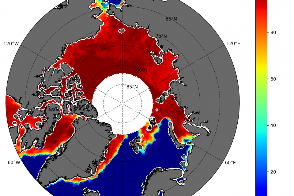
Sea ice concentration is important because it helps in determining important climate variables. Together with sea ice thickness, important fluxes between air and sea as well as heat transfer between the atmosphere can be determined. We designed an adapted bootstrap algorithm called SARAL/AltiKa Sea Ice Algorithm (SSIA) with some tunings and segregated the algorithm into winter and summer algorithms to estimate daily sea ice concentration (SIC) in the Arctic. Brightness temperature data from the dual-frequency microwave radiometer (23.8 GHz and 37 GHz) onboard the SARAL/AltiKa satellite for the period April 2013 to December 2020 are used to estimate SIC. We compare our product with the daily National Snow Ice and Data Centre Climate Data Record (NSIDC CDR)SIC, the Ocean and Sea Ice Satellite Application Facility (OSISAF) SIC, and the ARTIST Sea Ice Algorithm SIC (ASI) and results show that our sea ice concentration is of good quality and can be used as a basic dataset for SIC records.
The monthly sea ice concentration (sic) data files are provided in GeoTiff format with data type: Float 32. These data cover the Northern polar region at a 25 x 25 km grid cell size. The sic data are displayed in a polar stereographic projection with EPSG code: 3413. The Northern Hemisphere pole hole (the region around the pole not imaged by the sensor) and the land regions are assinged with NaN (not a number) value. The valid range of ice concentration is from 0% to 100%. This is the version 2 of this dataset with the removal of spurious sea ice and median filter applied. The file naming convention for the monthly files is as follows: saral_seaice_conc_monthly_nh_yyyymm.tif
- saral identifies SARAL/AltiKa data
- seaice_conc identifies sea ice concentration data
- monthly identifies monthly sea ice concentration
- nh identifies Northern Hemisphere
- yyyy identifies 4-digit year
- mm identifies 2-digit month
- .tif identifies a GeoTiff file


Comments
Hiii