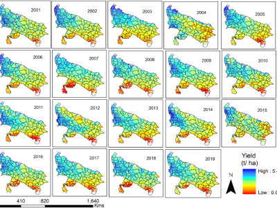
Adverse climatic events like heat stress, floods, unseasonal rainfall, and droughts frequently hinder crop productivity. Long-term crop yield data plays a crucial role in food security planning. This study presents historical wheat yield data at the satellite pixel level from 2001 to 2019 in Uttar Pradesh, India. We use various satellite indicators to develop wheat yield models, including the normalized difference vegetation index and gridded weather data, such as precipitation, temperature, and evapotranspiration.
- Categories:

