*.shp

We propose a road intersection identification method based on spatial constraint relationships of vector data. To evaluate its wide applicability, OpenStreetMap (OSM) data from seven cities–Berlin, Beijing, London, Nanjing, New York City, Rome, and Shanghai–were employed to identify road intersections of these cities.

Categories:
167 Views

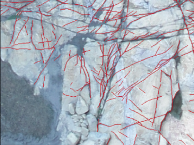
The dataset contains UAV imagery and fracture interpretation of rock outcrops acquired in Praia das Conchas, Cabo Frio, Rio de Janeiro, Brazil. Along with georeferenced .geotiff images, the dataset contains filtered 500 x 500 .png tiles containing only scenes with fracture data, along with .png binary masks for semantic segmentation and original georeferenced shapefile annotations. This data can be useful for segmentation and extraction of geological structures from UAV imagery, for evaluating computer vision methodologies or machine learning techniques.

Categories:
516 Views