Outdoor 3D Reconstruction Using Monocular Depth Estimation and Photogrammetric Point Clouds
- Citation Author(s):
-
ADRIAN WIDLAK

- Submitted by:
- Adrian Widlak
- Last updated:
- DOI:
- 10.21227/ts0v-tk55
 250 views
- Categories:
- Keywords:
Abstract
Augmented reality (AR) is a rapidly evolving field, yet research has predominantly focused on indoor applications, leaving outdoor environments relatively underexplored. Metric Depth Estimation (MDE) plays a pivotal role in AR, enabling essential functionalities such as object placement and occlusion handling by extracting depth and perspective information from single 2D images.
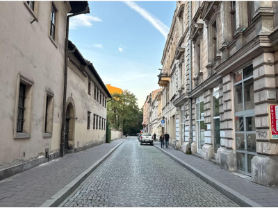
This repository contains data and code for evaluating 3D reconstruction methods using monocular depth estimation and photogrammetry. The data includes single outdoor images used for generating point clouds through monocular depth estimation models as well as a set of images with a resolution of 480x853 pixels, used to create reference point clouds via photogrammetry techniques. Scripts and tools for processing the images, generating point clouds are also included.
Instructions:
This repository contains all the necessary files and resources for the research project:
/ENVIRONMENT
Contains a .yaml configuration file for setting up the proper Python environment using Anaconda.
/POINT CLOUD
Includes generated point clouds based on Monocular Depth Estimation (MDE) models such as GLPN, ZOE, and DPT.
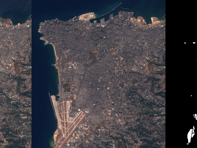
/OUTDOOR IMAGES
A collection of outdoor images used for photogrammetry-based 3D reconstruction.
/SCRIPTS
Contains Python scripts for generating point clouds based on single-image depth assessment.