Datasets
Standard Dataset
Kansas AHSI dataset
- Citation Author(s):
- Submitted by:
- Renjie Ji
- Last updated:
- Wed, 03/06/2024 - 02:41
- DOI:
- 10.21227/cdn8-db45
- Data Format:
- Research Article Link:
- License:
 413 Views
- Categories:
- Keywords:
Abstract
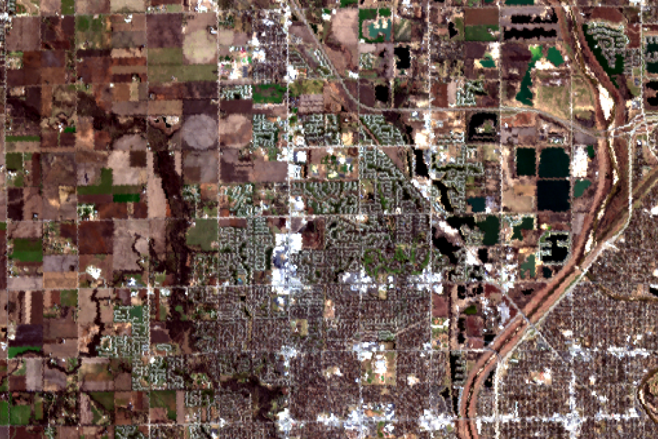
The Kansas AHSI dataset was collected by the visible-SWIR AHSI designed by the Shanghai Institute of Technical Physics, Chinese Academy of Sciences, which was one of the main payloads onboard the GF-5 satellite. The Kansas AHSI dataset covers 330 spectral bands to characterize the solar reflective regime from 400 to 2500 nm. The spectral resolution is about 5 nm for the visible and near infrared (VNIR) region from 400 to 1000 nm, and 10 nm for the visible-shortwave infrared (SWIR) region from 1000 to 2500 nm. The spatial resolution is around 30 m. The dataset was acquired over Kansas in USA in November 2018. The dataset size is 650×340 pixels. After geometric correction, radiometric correction, and other preprocessing, the interior objects in the study area were divided into seven categories by referring to Google Earth images of the same period and place. This dataset contains many crossroads and regular town districts, which can be used to demonstrate the visual performance of the different classification models.
If you think it helpful, we would appreciate if you cite these papers in your work.
Wang X, Tan K, Du P, et al. A unified multiscale learning framework for hyperspectral image classification [J]. IEEE Trans. Geoscience and Remote Sensing 2019, 1–14.
The file declaration:
1. “classification image.png”: The png format of ground truth.
2. “pseudocolor image.png”: The png format of pseudocolor.
3. “image.hdr”/“image.img”: The raster data format of the Kansas AHSI dataset
4. “gt.hdr”/“gt.img”: The raster data format of the ground truth
5. “gt_cls.hdr”/“gt_cls.img”: The ENVI classification format of the ground truth
Documentation
| Attachment | Size |
|---|---|
| 266.95 KB |


