Datasets
Standard Dataset
Manual segmentation results based on the joint data of satellite imagery and DSM
- Citation Author(s):
- Submitted by:
- Li Zhao
- Last updated:
- Fri, 06/18/2021 - 08:08
- DOI:
- 10.21227/97nq-yj29
- License:
 312 Views
- Categories:
Abstract
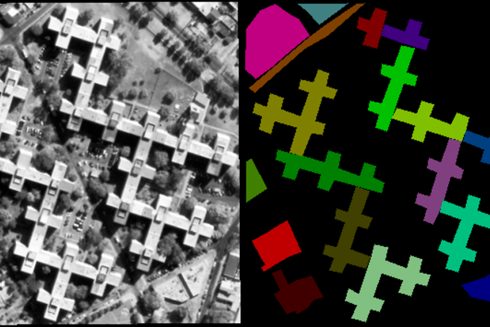
In the field of 3D reconstruction, although there exist some standard datasets for evaluating the segmentation results of close-up 3D models, these datasets cannot be used to evaluate the segmentation results of 3D models based on satellite images. To address this issue, we provide a standard dataset for evaluating the segmentation results of satellite images and their corresponding DSMs. In this dataset, the satellite images maintain an exact correspondence with the DSMs, thus the segmentation results of both satellite images and DSMs can be evaluated by our proposed dataset. Furthermore, to ensure the objectivity of the ground-truth results, each satellite image is segmented by five different people.
This dataset can be utilized to evaluate the segmentation accuracy of satellite images, digital suface model (DSM) and the joint data of satellite imagery and DSM. Therefore, this dataset consists of three parts: 1) satellite images, 2) DSMs and 3) ground-truth segmentation results. Moreover, DSM and satellite imagery correspond to each other, and the elevation data of DSM has been extracted and stored in the *.mat files.
The data composition is as follows:
1) Satellite images/ -- Panchromatic satellite images;
2) DSM data/ -- DSMs corresponding to satellite images. The DSMs maintain an alignment relationship with the satellite images, and the elevation data of thses DSMs has been extracted and stored in the *.mat files;
3) Ground-truth segmentation results/ --Manual segmentation results from five different people.
R01_json/ --Segmentation results corresponding to the first area, and the area labels and area edges are stored in the .mat file.
R02A_json/ --Segmentation results corresponding to the second area, and the area labels and area edges are stored in the .mat file.
R02B_json/ --Segmentation results corresponding to the third area, and the area labels and area edges are stored in the .mat file.
R02C_json/ --Segmentation results corresponding to the fourth area, and the area labels and area edges are stored in the .mat file.
R02D_json/ --Segmentation results corresponding to the fifth area, and the area labels and area edges are stored in the .mat file.


Comments
A standard dataset for evaluating the segmentation results of satellite images and their corresponding DSMs.