Datasets
Standard Dataset
Duckweed Detection Dataset
- Citation Author(s):
- Submitted by:
- Edwin Salcedo
- Last updated:
- Tue, 06/25/2024 - 17:35
- DOI:
- 10.21227/b89w-cz60
- Data Format:
- License:
 200 Views
- Categories:
- Keywords:
Abstract
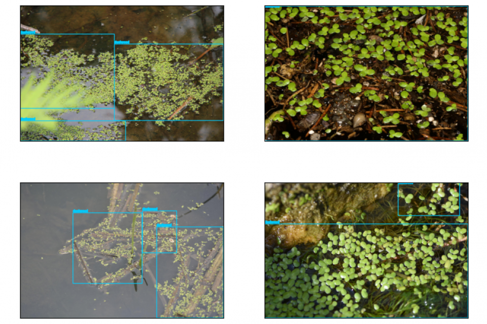
Deficient domestic wastewater management, industrial waste, and floating debris are some leading factors that contribute to inland water pollution. The surplus of minerals and nutrients in overly contaminated zones can lead to the invasion of different invasive weeds. Lemnaceae, commonly known as duckweed, is a family of floating plants that has no leaves or stems and forms dense colonies with a fast growth rate. If not controlled, duckweed establishes a green layer on the surface and depletes fish and other organisms of oxygen and sunlight. In the last decades, duckweed blooms have become an expensive plague to remove in Lake Titicaca, causing significant biodiversity and economic losses. To address this issue, we propose the development of an unmanned surface vehicle (USV) to continuously monitor and collect duckweed. This device includes a steering angle estimation system (SAE) that combines a duckweed detector, a steering angle classifier, and a momentum-inspired module to determine continuously the orientation of the USV when it is inspecting a zone. We train and test our deep learning-based models with two novel datasets: first, a dataset for end-to-end steering angle classification collected synthetically using a bespoke simulator; and second, a dataset for duckweed detection. The latter is published in the present page for its reuse by the community.
Image in PNG format
Bounding boxes in TXT and XML format
A CSV with labels about the point of view from where the pictures where captured. Four categories were considered: close, near-close, wide, and near-wide.


