Datasets
Standard Dataset
Road Intersection Data with Road-related characteristics of seven cities
- Citation Author(s):
- Submitted by:
- Tang Johnny
- Last updated:
- Tue, 07/04/2023 - 01:13
- DOI:
- 10.21227/xawr-9r78
- Data Format:
- License:
 210 Views
- Categories:
- Keywords:
Abstract
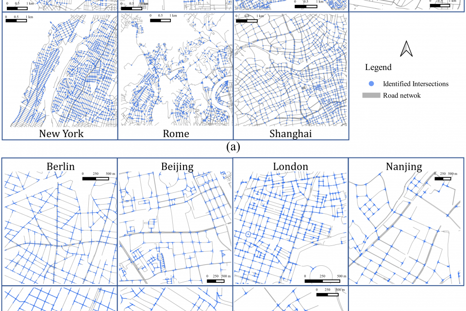
We propose a road intersection identification method based on spatial constraint relationships of vector data. To evaluate its wide applicability, OpenStreetMap (OSM) data from seven cities–Berlin, Beijing, London, Nanjing, New York City, Rome, and Shanghai–were employed to identify road intersections of these cities.
The first part of our approach involves the implementation of a vector-based fusion methodology to identify initial candidates for road intersections. The spatial constraint relationships in the vector data are then utilized to filter and process these candidates, thereby improving the accuracy of intersection identification. The second aspect of our methodology involves identifying road-related characteristics by conducting a graph-based analysis of associated roads and matching them with diverse layout templates.
The evaluation results indicated that the average precision, recall, and F1 scores in these regions were 98.79%, 97.55%, and 98.16%, respectively.
This dataset contains road intersection data of seven cities (Berlin, Beijing, London, Nanjing, New York City, Rome, Shanghai) identified by our proposed method.
The data of each city are stored in the folder named by its abbreviation.
In each folder, there will be five *.shp files.
1) Roadnetwork (roads.shp)
This layer stores the OSM road network with tag attributes.
2) Intersection points (cross-res.shp)
This layer stores the location of the intersection point and the general characteristics of the road layout, including the number of intersecting roads and layout type. This provides the necessary location information for mapping and spatial analyses.
3) Related road lines (fullLine-res.shp/fail-fullLine.shp)
The original road lines related to intersections extracted from the road networks were stored in this layer, preserving the inherent attributes of the original dataset. In addition, matching information, indicating whether the lines represent the same road, was stored as an attribute.
4) Synthesized road lines (simpleLine-res.shp)
The geometries of this layer store synthesized road lines representing road orientations, whereas the attributes store acquired characteristics, including roadway configurations and match indices, which allow the synthesized road lines to be connected to the original roads from which they were derived. This connection is achieved through “pt_id” linked with cross-res.shp and “match_id” linked with fullLine-res.shp.
Documentation
| Attachment | Size |
|---|---|
| 21.64 KB |


