Intelligent Vehicle Energy Saving and Obstacle Avoidance Driving Human Manipulation Dataset in Unstructured Environment

- Citation Author(s):
-
Hao Xu (Jilin University)
- Submitted by:
- xuhao xu
- Last updated:
- DOI:
- 10.21227/vrch-2e10
 720 views
- Categories:
- Keywords:
Abstract
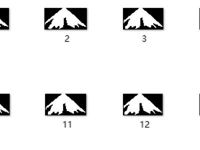
This dataset includes environmental perception, vehicle motion status, and battery consumption during vehicle operation. The dataset is collected by human operators during the safe and smooth operation of vehicles. By dividing the hazardous areas in the current environment of the vehicle and processing them, a radar map of the hazardous areas is generated; The vehicle motion status section contains the position information (x, y, z) and kinematic information (v, w, a, alpha, beta, gamma) of the vehicle. Alpha, beta, and gamma represent the heading angle, pitch angle, and roll angle of the vehicle, respectively; The power consumption situation refers to the cumulative consumption of electricity during vehicle operation
Instructions:
The dataset is divided into three parts, namely "Hazardous area data sets (radar maps)", "Inertial Navigation Dataset", and "Image datasets". Among them, the Hazardous area data sets (radar maps) evaluate the hazardous areas in the environment based on the current driving status of the vehicle and process the radar maps; The Inertial Navigation Dataset contains vehicle driving status data, battery consumption data, vehicle location information, etc; Image datasets are RGB images captured during vehicle operation.
Dataset Files
- Hazardous area data sets (radar maps)1.zip (Size: 28.18 MB)
- Hazardous area data sets (radar maps)2.zip (Size: 28.31 MB)
- Hazardous area data sets (radar maps)3.zip (Size: 28.17 MB)
- Hazardous area data sets (radar maps)4.zip (Size: 28.19 MB)
- Hazardous area data sets (radar maps)5.zip (Size: 28.17 MB)
- Hazardous area data sets (radar maps)6.zip (Size: 28.18 MB)
- Hazardous area data sets (radar maps)7.zip (Size: 28.21 MB)
- Hazardous area data sets (radar maps)8.zip (Size: 28.17 MB)
- Hazardous area data sets (radar maps)9.zip (Size: 28.12 MB)
- Hazardous area data sets (radar maps)10.zip (Size: 28.25 MB)
- Hazardous area data sets (radar maps)11.rar (Size: 27.69 MB)
- Hazardous area data sets (radar maps)12.rar (Size: 27.53 MB)
- Hazardous area data sets (radar maps)13.zip (Size: 28.19 MB)
- Hazardous area data sets (radar maps)14.zip (Size: 28.2 MB)
- Hazardous area data sets (radar maps)15.zip (Size: 28.2 MB)
- Hazardous area data sets (radar maps)16.zip (Size: 28.13 MB)
- Hazardous area data sets (radar maps)17.zip (Size: 28.19 MB)
- Hazardous area data sets (radar maps)18.zip (Size: 28.19 MB)
- Hazardous area data sets (radar maps)19.zip (Size: 28.16 MB)
- Hazardous area data sets (radar maps)20.zip (Size: 28.16 MB)
- Hazardous area data sets (radar maps)21.zip (Size: 28.14 MB)
- Hazardous area data sets (radar maps)22.zip (Size: 28.22 MB)
- Hazardous area data sets (radar maps)23.zip (Size: 28.19 MB)
- Hazardous area data sets (radar maps)24.zip (Size: 28.14 MB)
- Hazardous area data sets (radar maps)25.zip (Size: 28.18 MB)
- Hazardous area data sets (radar maps)26.zip (Size: 28.18 MB)
- Hazardous area data sets (radar maps)27.zip (Size: 28.17 MB)
- Hazardous area data sets (radar maps)28.zip (Size: 27.52 MB)
- Image datasets1.zip (Size: 11.14 MB)
- Image datasets2.zip (Size: 11.16 MB)
- Image datasets3.zip (Size: 11.13 MB)
- Image datasets4.zip (Size: 4 MB)
- Inertial Navigation Dataset1.rar (Size: 13.97 MB)
- Inertial Navigation Dataset2.zip (Size: 14.4 MB)
- Inertial Navigation Dataset3.zip (Size: 14.41 MB)
- Inertial Navigation Dataset4.zip (Size: 5.15 MB)


